
Page 29 - Croydon
P. 29
Drive in Couldson was severely affected and Local SuDS Specific Requirements possible, to accord with the London Plan managing flood risk in the Borough. The LPA
Local SuDS requirements
is a regular flooding hotspot. Sustainable Drainage Hierarchy; to achieve will seek to achieve less than Greenfield
Drainage Strategies and Flood Risk better than greenfield runoff rates; to be Runoff rates from all re-development sites.
The most recent significant groundwater Assessments for all proposed major designed to be multifunctional and
flooding event took place in 2013-2014 in developments within Croydon must comply incorporate sustainable drainage into The southern part of the Borough, which is
areas of Kenley and Purley, along the route of with the requirements of the London Plan, landscaping and public realm to provide widely underlain by Chalk, has potential for
Caterham Bourne, and around South National Planning Policy Framework (and opportunities to improve amenity and infiltration discharge.
Coulsdon, along the route of Merstham associated guidance) and the latest Croydon biodiversity; to achieve improvements in When a site is in Source Protection Zone 1
Bourne. Several groundwater observation Local Plan. water quality through a sustainable drainage Local SuDS requirements
boreholes are located in and around the system management train; and to be and 2, development proposals should
account demonstrate that the risk of
Bourne catchment; in Woldingham and Local Plan Strategic Policy SP6.4 requires the designed with consideration of future
Purley Bury. Instances of groundwater Council, as the Lead Local Flood Authority, to maintenance. groundwater contamination has been
appropriately assessed and that the relevant
flooding have been also reported in areas work in partnership with the Environment
around Upper Norwood; Thornton Heath and Agency, community groups, water and London Borough of Croydon has suffered permissions have been sought from
Environment Agency
Ashburton. highways infrastructure providers, developers significant surface water flooding due to
and other Lead Local Flood Authorities to intense rainfall exceeding the capacity of the Local Planning Authority and
reduce flood risk, protect groundwater and existing drainage infrastructure; leading to
aquifers, and minimise the impact of all forms substantial overland flow and ponding of Stakeholder Engagement
of flooding in the borough. This will be surface water in low lying areas. All planning applicants are strongly advised
achieved by: a. Applying the Sequential Test to seek pre-application advice from LPA prior
and Exception Test where required by Policy to development of scheme designs. The
DM25; b. Requiring major developments in ’LLFA’s requirements for SuDS are illustrated
Flood Zone 1 and all new development within in Croydon Council’s website: https://www.
23 Flood Zones 2 and 3 to provide site specific croydon.gov.uk/environment/flood-water/ 24
Flood Risk Assessments proportionate with advice-to-planning-applicants.
the degree of flood risk posed to and by the
development, taking account of the advice Further information on SuDS can be found in
London Fire Brigade evacuations by boat in and recommendations within the Council’s the same link.
Dale Road, February 2014 (Source: Croydon Strategic Flood Risk Assessment and Surface Adoption and maintenance of SuDS
Council - various officers) Water Management Plan; c. Requiring all
New Addington, as well as the south of the development, including refurbishment and Croydon Council will consider adopting SuDS
Borough, have been known to experience conversions, to utilise sustainable drainage features that are constructed in public spaces
foul sewer flooding during extreme rainfall systems (SuDs) to reduce surface water if they provide benefits to Croydon residents.
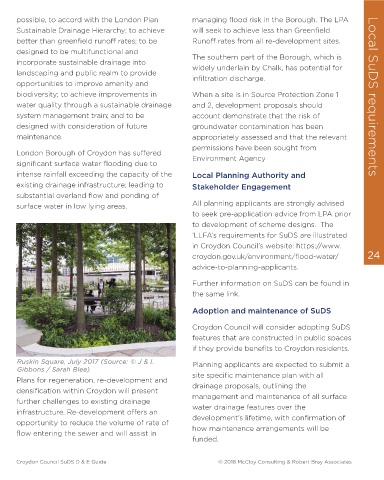
© J & L Gibbons | Sarah Blee
events caused by the foul sewer network run-off and provide water treatment on site; Ruskin Square, July 2017 (Source: © J & L Planning applicants are expected to submit a
being inundated with surface water as a and d. Requiring development proposals to Gibbons / Sarah Blee) site specific maintenance plan with all
result of legal and/or illegal connections to account for possible groundwater Plans for regeneration, re-development and drainage proposals, outlining the
the foul sewer network. Notable problem contamination in Source Protection Zones 1 densification within Croydon will present management and maintenance of all surface
areas include Caterham Drive, Marlpit Lane, and 2. further challenges to existing drainage water drainage features over the
infrastructure. Re-development offers an
Chaldon Way and Coulsdon Road. Local Plan DM25.3 requires SuDS to be opportunity to reduce the volume of rate of development’s lifetime, with confirmation of
included in all development to ensure runoff flow entering the sewer and will assist in how maintenance arrangements will be
is managed as close to the source as funded.
Croydon Council SuDS D & E Guide © 2018 McCloy Consulting & Robert Bray Associates Croydon Council SuDS D & E Guide © 2018 McCloy Consulting & Robert Bray Associates