
Page 25 - High Knob Master Plan
P. 25
WAYFINDING
As part of the High Knob Regional Initiative (HKRI) planning process, a review of existing conditions of the region’s wayfinding signs was performed in order to provide guidance on wayfinding destination inclusion criteria, present concepts, and recommend implementation and management strategies.
ASSESSMENT OF EXISTING WAYFINDING
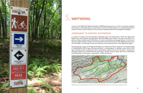
A number of images and documentation regarding assets and destinations within the High Knob Region have been collected through efforts from the HKRI Action Teams. The goal of this effort is to assess existing conditions and the efficiency of current wayfinding and signage systems. At the time of this plan, approximately 138 signs were inventoried in the eastern portion of the High Knob study area. The committee is continuing to work on inventories in the western portion of the High Knob region.
Existing signage systems in the High Knob Region are comprised of 5 basic categories: Green Department of Transportation (DOT) signs directing motorists to municipalities or alternate routes, Brown DOT signs pointing toward recreational assets or destinations, Historic Byway & Trail signs, community & destination gateways, and State Route & traffic signs. Outside of brown signs, there are no destination wayfinding signs in the region, communities, or their downtowns.
Wayfinding in the region that directs visitors to the High Knob Recreation Area. See Chapter 8 for enlarged versions.
25
