
Page 28 - High Knob Master Plan
P. 28
PUBLIC AND PRIVATE DESTINATIONS
Based on the stipulations in the Manual for Universal Traffic Control Devices (MUTCD), proposed wayfinding concepts seek to determine various types of public destinations to be included in the wayfinding system. A partial list below identifies various types of destinations. The Asset Action Team is currently developing a full list of regional assets and destinations to be used to build a complete wayfinding system. Private and for-profit businesses are not eligible for inclusion in a wayfinding system.
There are a number of other transportation systems that exist in the region such as bike lanes on public roads or share-lane strategies that may have their own dedicated signage. While this infrastructure is very important, it is part of transportation and traffic management, so was not addressed in this destination-based signage strategy. Similarly, green and white VDOT and Federal signage are not part of a destination-based wayfinding system.
Potential destinations should go through a ranking process in order to establish a hierarchy of importance. The criteria upon which these destinations will be measured include: Number of Employees, Ease of Access, Parking Resources, Seasonality, Hours of Operation, and Regional Significance.
An implementation tool was developed as part of the High Knob Master Plan. This spreadsheet will assist the High Knob Regional Initiative (HKRI) in ranking destinations based on the criteria above. While this spreadsheet should be used as a guide, it is important that local knowledge be used to determine which destinations to be signed. (Chapter 10)
TYPES OF DESTINATIONS IN THE HIGH KNOB REGION
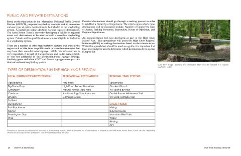
Guest River Gorge. Example of a destination that would be included in a regional wayfinding system
LOCAL COMMUNITIES/DOWNTOWNS:
Appalachia
Big Stone Gap Clinchport Coeburn Dryden
Duffield Dungannon
Fort Blackmore Norton Pennington Gap Wise
RECREATIONAL DESTINATIONS:
Flag Rock
High Knob Recreation Area Natural Tunnel State Park Boat Landings/Kayak Access Camping Areas
REGIONAL TRAIL SYSTEMS:
Spearhead
Crooked Road
VA Scenic Byways
Daniel Boone Wilderness Trail VA Coal Heritage Trail
LOCAL TRAILS:
Hiking
Bicycle Routes Mountain Bike Trails Water
Birding
ATV
Examples of destinations that may be included in a wayfinding system. Once a complete list of destinations is created by the HKRI Asset Action Team, it will use the ‘Wayfinding Destination Scoring Criteria’ spreadsheet tool developed as part of this plan
28 CHAPTER 5: WAYFINDING
HIGH KNOB REGIONAL INITIATIVE
