
Page 39 - The Black Range Naturalist Vol. 4, No. 3
P. 39
area. The frame grab below is from
Mines of the Hillsboro Mining District - Vol. 1 (at 35:43). Early mining operations were continually involved in “dewatering” and reframing. Every time a mine changed ownership, which was frequently, the new owners would raise capital to “dewater” the mine, bringing in the latest pumps to get the water out so the mines could be worked. Water seepage was generally more of a problem than the supply of clean air. Clean air was only an issue if you could get the water out. Flooded mines also tended to rot the timbers that framed shafts and adits, thus the continual reframing. And reframing was not a trivial matter. In most of the mine shafts which dot the hills the framing has been removed, but at some, like the Bigelow, shown below, the framing is still intact.
series, looking downward, at about seventy feet down the shaft.
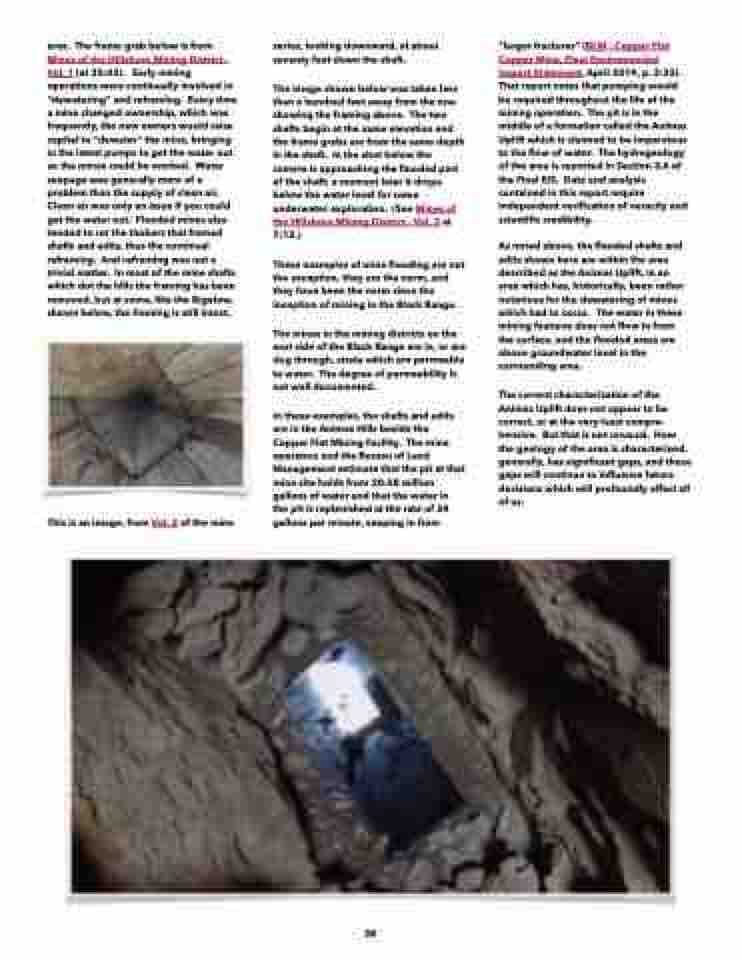
The image shown below was taken less than a hundred feet away from the one showing the framing above. The two shafts begin at the same elevation and the frame grabs are from the same depth in the shaft. In the shot below the camera is approaching the flooded part of the shaft; a moment later it drops below the water level for some underwater exploration. (See Mines of the Hillsboro Mining District - Vol. 3 at 7:13.)
These examples of mine flooding are not the exception, they are the norm, and they have been the norm since the inception of mining in the Black Range.
The mines in the mining districts on the east side of the Black Range are in, or are dug through, strata which are permeable to water. The degree of permeability is not well documented.
In these examples, the shafts and adits are in the Animas Hills beside the Copper Flat Mining Facility. The mine operators and the Bureau of Land Management estimate that the pit at that mine site holds from 20-28 million gallons of water and that the water in the pit is replenished at the rate of 24 gallons per minute, seeping in from
“larger fractures” (BLM - Copper Flat Copper Mine, Final Environmental Impact Statement, April 2019, p. 2-32). That report notes that pumping would be required throughout the life of the mining operation. The pit is in the middle of a formation called the Animas Uplift which is claimed to be impervious to the flow of water. The hydrogeology of the area is reported in Section 3.6 of the Final EIS. Data and analysis contained in this report require independent verification of veracity and scientific credibility.
This is an image, from Vol. 2 of the mine
As noted above, the flooded shafts and adits shown here are within the area described as the Animas Uplift, in an area which has, historically, been rather notorious for the dewatering of mines which had to occur. The water in these mining features does not flow in from the surface, and the flooded areas are above groundwater level in the surrounding area.
The current characterization of the Animas Uplift does not appear to be correct, or at the very least compre- hensive. But that is not unusual. How the geology of the area is characterized, generally, has significant gaps, and those gaps will continue to influence future decisions which will profoundly affect all of us.
38
