
Page 37 - The Black Range Naturalist Vol. 4, No. 3
P. 37
Black Range
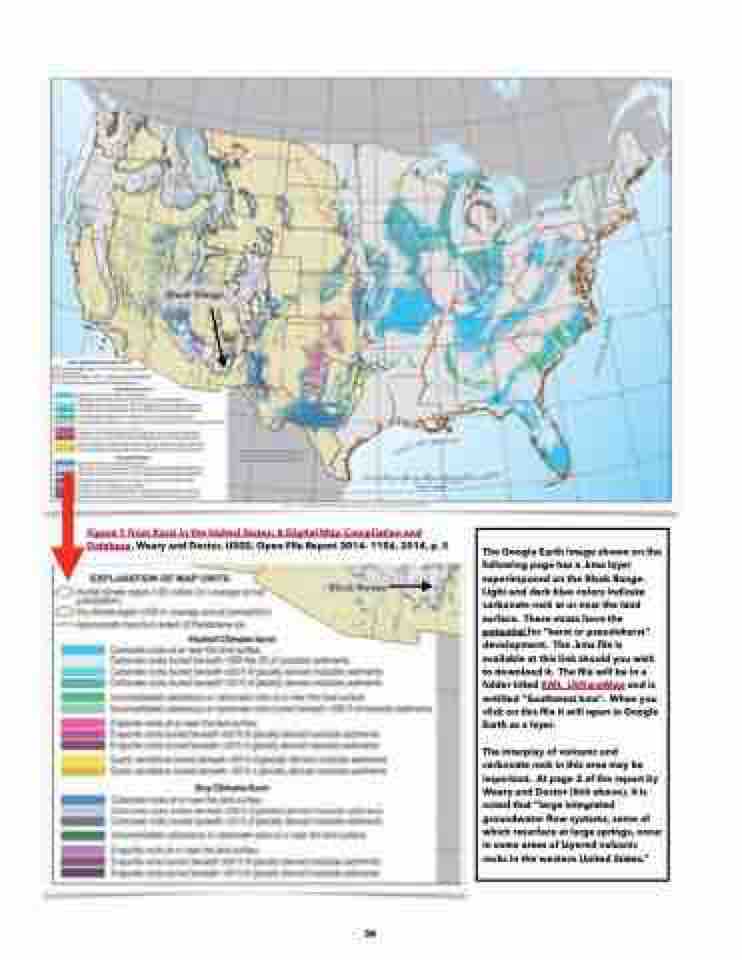
Figure 1 from Karst in the United States: A Digital Map Compilation and Database, Weary and Doctor, USGS, Open-File Report 2014- 1156, 2014, p. 5
Black Range
The Google Earth image shown on the following page has a .kmz layer superimposed on the Black Range. Light and dark blue colors indicate carbonate rock at or near the land surface. These strata have the potential for “karst or pseudokarst” development. The .kmz file is available at this link should you wish to download it. The file will be in a folder titled KML_USKarstMap and is entitled “Southwest kmz”. When you click on this file it will open in Google Earth as a layer.
The interplay of volcanic and carbonate rock in this area may be important. At page 2 of the report by Weary and Doctor (link above), it is noted that “large integrated groundwater flow systems, some of which resurface at large springs, occur in some areas of layered volcanic rocks in the western United States.”
36
