
Page 35 - The Silver Fire
P. 35
THE BLACK RANGE RAG - WWW.BLACKRANGE.ORG
12,000 Acre Growth on Silver Fire (Con’t)
the communities of San Juan, Sherman, and the City of Rocks State Park. Forest and road closure information can be found at: http://fs.usda.gov/gila or www.nmroads.com.
Silver Fire updates can be found on Inciweb at http://inciweb.nwcg.gov/ incident/3414. For additional fire information, visit the following websites: www.facebook.com/ SilverFireNM, www.flickr.com/ gilaforest,www.twitter.com/ SilverFireNM.
June 21, 8:30 P.M. Update
North End of Silver Fire Remains Active - The north end of the Silver Fire remains active and a smoke column reaching 46,000 feet into the sky was visible today.
Firefighters on the northeast side of the fire worked on strengthening existing containment line by conducting a burnout operation. Today’s operations did not affect the residents of Kingston who were allowed back into their homes yesterday. On the northwest side of the fire, firefighters spent the day scouting the steep timbered country along the continental divide looking
for old prescribed burn areas to tie into for a containment line. The fire remains at about 44,600 acres and about 20 percent contained. The southern half of the fire shows little activity and no threat is posed to the Royal John Mine.
Strong winds have posed a challenge to firefighters over the last few days. Today was no different as a combination of smoke and turbulence resulted in the helicopters working the fire to be grounded. The hot, dry and windy conditions are expected to continue through the weekend.
Approximately 70 residents attended a public meeting in San Lorenzo this evening. Fire managers and forest officials described current fire activity, planned containment strategies and touched on post-fire recovery.
Motorists are reminded that the 25- mile route on NM State Highway 61 from its junction with NM 152 to U.S. Highway 180 is open. Motorists
traveling along NM 61 pass through the communities of San Juan, Sherman, and the City of Rocks State Park. Forest and road closure information can be found at: http:// fs.usda.gov/
gila or www.nmroads.com.
Silver Fire updates can be found on Inciweb at http://inciweb.nwcg.gov/ incident/3414. For additional fire information, visit the following websites: www.facebook.com/ SilverFireNM,www.flickr.com/ gilaforest, www.twitter.com/ SilverFireNM.
June 23 - Silver Fire Covers More than 70,000 Acres
As of this posting the Silver Fire has consumed 70,000 acres.
Visit the official fire site for the latest and best information: Silver Fire Site
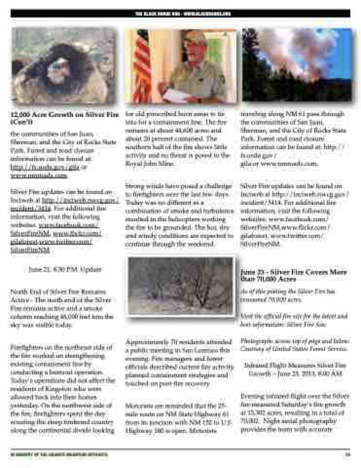
Photographs across top of page and below: Courtesy of United States Forest Service.
Infrared Flight Measures Silver Fire Growth – June 23, 2013, 8:00 AM
Evening infrared flight over the Silver fire measured Saturday’s fire growth at 13,302 acres, resulting in a total of 70,002. Night aerial photography provides the team with accurate
iN MEMORY OF THE GRANITE MOUNTAIN HOTSHOTS
35
