
Page 8 - Advanced Life of Christ - Student Textbook
P. 8
The Jezreel Valley, separating the hills of Galilee from those of Samaria, is Israel's richest agricultural
area, cultivated by many cooperative communities (kibbutzim and moshavim). The rolling hills
of Samaria and Judea (the West Bank) present a mosaic of rocky hilltops and fertile valleys, dotted with
groves of age-old, silver-green olive trees. The terraced hillsides, first developed by farmers in ancient
times, blend into the natural landscape. The population is concentrated mainly in small urban centers
and large villages.
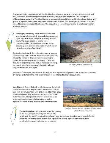
The Negev, comprising about half of Israel's land
area, is sparsely inhabited, its population supported
by an agricultural and industrial economy. Further
south, the Negev becomes an arid zone
characterized by low sandstone hills and plains,
abounding with canyons and wadis in which winter
rains often produce flash floods.
Continuing southward, the region gives way to an area
of bare craggy peaks, craters, and rock-strewn plateaus,
where the climate is drier, and the mountains are
higher. Three erosive craters, the largest of which is
about 5 miles (8 km.) across and 21 miles (35 km.) long,
cut deeply into the earth's crust, displaying a broad The Negev (Photo: S. Lederhendler)
range of colors and rock types.
At the tip of the Negev, near Eilat on the Red Sea, sharp pinnacles of gray and red granite are broken by
dry gorges and sheer cliffs, with colorful layers of sandstone glowing in the sunlight.
Lake Kinneret (Sea of Galilee), nestled between the hills of
Galilee and the Golan Heights at 695 feet (212 m.) below
sea level, is 8 km. (5 miles) wide and 21 km. (13 miles) long.
It is Israel's largest lake and serves as the country's main
water reservoir. Along Lake Kinneret's shores are some
important historical and religious sites, as well as
agricultural communities, fisheries and tourist facilities.
View from Kinneret village to the lake and Golan Heights
The Jordan Valley and the Arava, along the country (Photo: Ministry of Tourism)
in the east, are part of the Syrian-African Rift,
which split the earth's crust millions of years ago. Its northern stretches are extremely fertile,
while the southern portion is semi-arid. Agriculture, fishing, light industry and tourism
constitute the area's main sources of income.
7