
Page 20 - 2022_Mountain Maryland Destination Guide_Neat
P. 20
2022_MM-TEXT.qxp_Layout 1 3/25/22 7:46 AM Page 18
Road Cycling
in Mountain Maryland
creek valleys to elevations over 3,000 feet as you approach Garrett
County to the west. This elevation change, and the accompanying
temperature variation and weather patterns, actually proves
beneficial in deciding where to find the best riding conditions from
summer to winter. During the dog days of summer as the mercury
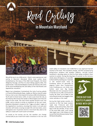
We will let you in on a li le secret there’s some spectacular road climbs above 90 degrees, it’s possible
cycling in Mountain Maryland. While most cyclists know to find relief by starting your road ride
Cumberland as the nexus of the C&O Canal Towpath, the Great in the western most town of
Allegheny Passage, and fine mountain biking opportuni es, the Frostburg, where it’s generally 10
paved roads in and around Allegany County will lead you into some degrees cooler than Cumberland.
of the most breathtaking hills and valleys of the mid Atlan c and From Frostburg you can climb even
Appalachian mountains. further west over Big Savage
Beginning in downtown Cumberland, the hub of cycling ac vity Mountain into the cool green forests
and home of three bicycle shops, roadies can find an array of routes of Garrett County, MD, and Somerset
from as short as ten miles long to full century (100 mile) distances. County, PA. Here, you’re likely to see
You'll want to travel west, north, or east as you leave the city, as more Amish horses and buggies than CHECK OUT OUR
the Potomac River forms the border to West Virginia and limits the motor vehicles on the roads.
routes to the south. The road routes quickly become rural, low During the frigid winter months, it’s ROUTES PLANNER
tra c, and as varied in terrain as anywhere on the east coast. common to find the lower eastern
Mountain Maryland is located in the “ridge and valley” region of roads near Flintstone and Li le IN RIDE WITH GPS
the Appalachian mountains, meaning that routes in an east west Orleans snow and ice free, o en with
direc on will involve crossing mul ple hills and mountains, some days in the 50s and 60s. In fact, many
with grades over 15 percent, but for a more level ride, s ck to the of the local bike clubs’ early spring
valleys in routes with north south orienta on. rides begin near Li le Orleans at the
As varied as the terrain can be, the weather can change Locust Post Farm Brewery below Town
dramatically as you travel from lower elevations in the river and Hill Bed & Breakfast.
18 | 2022 Destination Guide