


Page 42 - maintg
P. 42
River Country. The area, while richly steeped in
                                                                                history, offers a wide variety of distinctly modern
                                                                                activities and opportunities to experience this
                                                                                rewarding region. The evolution of the area has
                                                                                been guided by  one constant: the Mighty Peace
                                                                                River and the history and fortune flowing along it.
                                                                                One can still visit “Carter’s Camp” where Anna
                                                                                and Art Carter ran the freight barges on the Peace
                                                                                in years gone by.
                                                                                  Nearby George Lake offers camping, boating,
                                                                                and canoeing and swimming.
                                                                                Clear Hills County
                                                                                  Located along the British Columbia border in
                                                                                NW Alberta, the beautiful vast expanse of Clear
                                                                                Hills County is 5,836 square miles  of  Peace
                                                                                Country quietude at its best. A top-notch camping
                                                                                experience  awaits  at  any  of  the  great  facilities
                                                                                located at Ole’s Lake, Clear River, Worsley RV
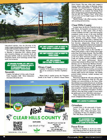
                                                               Dunvegan Suspension Bridge  Park, Running  Lake, Many  Islands, Carter’s
                                                                       photo by:  Camp, Stoney Lake, Sulfur Lake, or George Lake.
                                                                      Wilson Hui  The lakes offer fun for the whole family, including
                                                                                boat launches, playgrounds, hiking trails and
                                                                                swimming. Many species of fish and game abound;
      international attention since the discovery of the                        experienced guides and outfitters are available to
      world’s largest Pachyrhinosaurus dinosaur bone bed,   JCT. HWY 2 NORTH & HWY 49 WEST TO   ensure a memorable and rewarding trip.
      packed with hundreds of dinosaur bones.   SPIRIT RIVER & DAWSON CREEK       Visitors can play 9 holes at the Cleardale or
        The  Philip  J.  Currie  Dinosaur  Museum  opened                       Hines Creek courses or take in Heavy Horse Days
      in  Wembley  in  September  2015,  offering  cutting                      at the Clear River Rodeo Grounds. The Clear Hills
      edge interactive displays and extensive fossil and   JCT. HWY 2 NORTH & HWY 64 WEST TO   annual Agricultural Trade Show is held in April
      geological exhibits, hands-on research lab, National   HINES CREEK        at the Dave Shaw Memorial Complex in Hines
      Geographic theatre, smart technology enabled class                        Creek and includes pancake breakfast, exhibits,
      rooms, and restaurant.
                                                    JCT. HWY 2 NORTH &          banquet, and music performances. Several
                                                HWY 64 WEST TO HINES CREEK      cultural sites include the Hines Creek End of Steel
         AT GRANDE PRAIRIE JCT. HWY 43 &                                        Museum and the Homestead Heritage Museum.
         HWY 2 NORTH TO GRIMSHAW (MILE 0                                        The All Saints Anglican Church was declared a
             OF MACKENZIE HWY 35 TO        Hines Creek                          Municipal Historic Resource in 2009. The church
             NORTHWEST TERRITORIES           Location: At the junction of Highways 64 and   has been a beacon to the surrounding communities
                                             685; 25 km northwest of Fairview. Population:   for over 80 years and is a wonderful example of
      Sexsmith                               435.                               frontier gothic revival with features  that include
        Location: On highway 2; 24 km north of Grande                           pointed arched windows, vaulted sanctuary and
        Prairie. Population: 2200.  Visitor Information:   Hines Creek is nestled among the “Forgotten   hand hewn pews.
        www.sexsmithchamber.com.           Jewels  of  the  Peace”  in Alberta’s  famous  Peace   Wintertime enthusiasts will enjoy skiing Peace
                                                                                Country at the  Whispering Pines Ski Hill near
                                                                                Worsley  and  snowmobiling  on  the  Peace Valley
                                                                                Snow Riders snowmobile trail network. Ice fishing,
                                                                                snow shoeing to remote locales, rousing games of
                                                                                pond hockey, and old-fashioned tobogganing are
                                                                                also exceptional. Northern Lights viewing is jaw-
                                                                                dropping and unsurpassed throughout Northern
                                                                                Alberta in the crisp winter months, so come watch
                                                                                the spirits perform their 900-billion watt dance!
                                                                                  Visitor Information: Phone (780) 685-3925 or
                                                                                Email: info@clearhillscounty.ab.ca

                                                                                      HWY 2 NORTH TO GRIMSHAW

                                                                                Grimshaw
                                                                                  Location:  Hwy 2;  108  miles  north  of  Grande
                                                                                  Prairie,  13 miles  south of Peace  River.
                                                                                  Population:  2810. Visitor  Information: Town
                                                                                  of Grimshaw, PO Box 377, Grimshaw, Alberta
                                                                                  T0H 1W0; Phone: (780) 332-4626.


                                                                                        JCT. MACKENZIE HWY 35
                                                                                        NORTH TO HIGH LEVEL
                                                                                     & HWY 2 EAST TO PEACE RIVER
                                                                                Peace River
                                                                                  Location:  On Highway 2; 24 km (14 miles)
                                                                                  east of Mackenzie Hwy 35; 486 km (295 miles)
                                                                                  northwest of Edmonton and 195 km (115 miles)

     40

