
Page 26 - eatg
P. 26
purposes, but also to provide education, health care,
and new opportunity to the people of the Western
Arctic. Inuvik is the main headquarters for the oil
and gas industry in the Beaufort Sea and Mackenzie
Delta, offering a full range of accommodations,
restaurants, and specialty shops.
For those who are adventurous and want to
get off the beaten path, the power and marvellous
scenery of the Arctic cannot be underestimated.
Journey north of the Arctic Circle and one of the
local tour companies can host you on an experience
of a lifetime. Enjoy the Inuvialuit and Gwich’in
culture, trek under the midnight sun, photograph
a variety of northern flora, and fauna or drive the
Dempster Highway or ice road.
Several Inuvik companies offer charter air, river
and overland tours through the entire region, from
casual boat cruises and sea kayaking expeditions
to low flying charter flights and helicopter tours,
exploring the rugged coast, remote islands, and
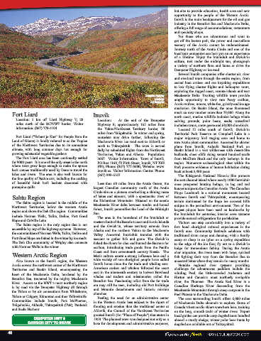
Dempster Highway vast Mackenzie Delta. Exciting wildlife tours
photo by: provide ample opportunity to view rare Peary
J.F. Bergeron caribou, Arctic wolves, moose, white fox, grizzly,
and ice age muskoxen. On Banks Island, the once
Fort Liard Inuvik threatened musk ox now number more than 70,000.
Along the north coast, marine wildlife includes
Location: 5 km off Liard Highway 7; 28 Location: At the end of the Dempster beluga whale calving grounds, polar bears, seals;
miles north of the BC/NWT border. Visitor Highway 8; approximately 165 miles from waterfowl includes swans, snow geese, and 60,000
information: (867) 770-4104. the Yukon/Northwest Territory border, 80 shorebirds.
miles from Tsiigehtchic. In winter and spring, Located 12 miles south of Inuvik, Gwich’in
Fort Liard (“Echaot’je Kue” for People from the motorists may drive further, following the Territorial Park Reserve on Campbell Lake is a
Land of Giants) is fondly referred to as the Tropics Mackenzie River ice road east to Aklavik or major migratory bird staging area and home to
of the Northwest Territories due to its anomalous north to Tuktoyaktuk. The town is served rare Arctic plant communities. Accessed by charter
climate, with long summer days hot enough for daily by scheduled flights from the Northwest plane from Inuvik, Aulavik National Park on
growing substantial vegetable gardens. Territories, Yukon and Alberta. Population: Banks Island is a vast wilderness with desert-like
The Fort Liard area has been continually settled 3667. Visitor Information: Town of Inuvik, badlands, sheer cliffs rising several hundred yards
for 9000 years. It is one of the only areas in the north PO Box 1160, #2 Firth Street, Inuvik, NT X0E from McClure Strait and the only icebergs in the
where trees grow large enough to make the spruce 0T0; Phone: (867) 777-8600; Website: www. region. Numerous archaeological sites within the
bark canoes traditionally used by Dene to travel the inuvik.ca. Visitor Information Centre: Phone: Park preserve evidence of human habitation dating
lakes and rivers. The area is also well known for (867) 993-6167. back at least 3,400 years.
the fine quality of Native arts, including the crafting The Kittigazuit National Historic Site protects
of beautiful birch bark baskets decorated with Less than 60 miles from the Arctic Ocean, the the east channel island where nearly 1000 Inuvialuit
porcupine quills. largest Canadian community north of the Arctic once prospered hunting beluga, in log and sod
Circle sits on a plateau overlooking a shining maze houses unique to the Canadian Arctic. The Canadian
Sahtu Region of lakes and streams, with a spectacular view of Pingo Landmark is a national monument located
The Sahtu region is located in the middle of the the Richardson Mountains. Situated on the scenic between Inuvik and Tuktoyaktuk, encompassing
Mackenzie River delta between tundra and boreal
Northwest Territories, below the western Arctic forest, Inuvik personifies the Land of the Midnight terrain dominated by the huge ice covered hills
region and above the Deh Cho region. Communities Sun. unique to the permafrost environment. Two of the
largest pingos have been used as landmarks by
include Norman Wells, Tulita, Deline, Fort Good The area is the homeland of the Inuvialuit or the Inuvialuit for centuries; interior cave systems
Hope, and Colville Lake. western Inuit of the Beaufort coast and Arctic Islands provide natural refrigeration for perishables.
The Sahtu region is the only region that is not and the Gwich’in, whose territory extends from Visitors can step comfortably into a variety of
accessible by any of the highway systems. However, Alaska and the northern Yukon to the Mackenzie first hand aboriginal cultural experiences in the
the communities of Norman Wells, Tulita, Deline, Valley. Ancestral Inuvialuit traveled with the Inuvik area. Community festivals celebrate with
and Fort Good Hope are linked in the winter by ice seasons to gather fish and game. The Gwich’in traditional drum songs and dancing; visit a family
roads. The Deh Cho community of Wrigley also fished the rivers for char and hunted the Barrens for camp or sleep in an igloo on a spring expedition
connects with Norman Wells in the winter. caribou, introducing trade goods from the Pacific to the edge of the ice floe; fly out to a Gwich’in
Coast and from seventeenth century Russia. The lodge for tremendous fishing. During the Arctic
Western Arctic Region Metis culture exerts a strong influence here and a char migration, the rivers teem with large, spirited
Also known as the Inuvik region, the Western wide variety of non-aboriginal people have called fish fighting their way from the Beaufort Sea to
Arctic covers the northwest corner of the Northwest Inuvik home since the fur trade and whaling eras. ancestral lakes where they remain for many months.
Territories and Banks Island, encompassing the American sealers and whalers followed the coast Notable regional river systems providing
heart of the Mackenzie Delta, bordered by the east in the nineteenth century to harvest Bowhead challenge for adventurous paddlers include the
Beaufort Sea, traversed by the mighty Mackenzie whales and traders and missionaries sailed the winding Peel, the little-traveled Anderson and
River. Access to the NWT’s most northerly region Beaufort Sea. Fascinating relics from the fur trade Horton, and Canada’s most northerly navigable
river, the Thomsen. The Arctic Red River is a
is by road via the Dempster Highway #8 through era may still be seen, including old Post buildings Canadian Heritage River descending from the
and Mountie detachments and historic mission
the Yukon or by air connections from Whitehorse, churches. Mackenzie Mountains through steep canyons in the
Yukon or Calgary, Edmonton, and then Yellowknife. Feeling the need for an administrative center Peel Plateau to the Mackenzie Delta.
Communities include Inuvik, Fort McPherson, in the Western Arctic less subject to the rigors of The area surrounding Inuvik offers 6,000 miles
Tsiigehtchic, Aklavik, Tuktoyaktuk (Tuk), Paulatuk, flooding and erosion than the traditional center at of Mackenzie Delta channels to explore. Some of
and Sachs Harbour. Aklavik, the Council of the Northwest Territories Canada’s best nordic skiers were born here, training
granted Inuvik (for “Place of People”) that status on the long, smooth trails of winter rivers. Expert
DEMPSTER HWY 8 in 1958. The planned town was designed not only local guides can provide cozy dogsled tours bundled
DAWSON CITY TO INUVIK as a base for development and administrative aboard a sturdy sledge; winter polar bear hunts by
dogsled are available out of Tuktoyaktuk.
48