
Page 34 - eatg
P. 34
YELLOWHEAD HWY 16
Mt. Robson Provincial Park
Location: The Park shares its eastern boundary
with Jasper National Park in Alberta, along the
Continental Divide. Enter British Columbia on
the Yellowhead Highway #16 over Yellowhead
Pass into Mt. Robson.
JCT. YELLOWHEAD HWY 16 & YELLOW-
HEAD SOUTH HWY 5 TO KAMLOOPS
Tete Jaune Cache
Location: Junction of the Yellowhead South
Highway 5 and Yellowhead Highway 16;
211 miles north of Kamloops, 160 miles east
of Prince George, 60 miles west of Jasper, 7
miles west of Mount Robson. Located at the
confluence of the Fraser and Robson Rivers,
at the southern end of the Cariboo Mountains
and the northern end of the Monashee Range.
Barkerville Population: 1500.
photo by:
Town of Barkerville Valemount
Location: Valemount is located on the
Telegraph Cove Bridge Lake, Lac des Roches, Sheridan, Machete, Yellowhead Highway 5 near the northern tip
Location: Off Hwy 19 on Vancouver Island, 210 Bonaparte, and Canim Lakes. Hwy 24 begins seven of Kinbasket Lake; 14 miles (22 km) south
of Tete Jaune Cache and 200 miles (320
km (130 miles) northwest of Campbell River. miles south of 100 Mile House and runs east over km) north of Kamloops. Population: 1,244.
Population: 20. McDonald Summit to Little Fort, a community on the
North Thompson River. It is one of three main routes Visitor Information: Valemount Chamber
joining Yellowhead Hwy 5 and Hwy 97. of Commerce, PO Box 690 Valemount, BC
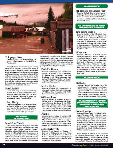
Telegraph Cove is a former fishing and cannery V0E 2Z0; Phone: (250) 566-0061; Email:
village, named in a poll of Canadian travel writers as 100 Mile House info@valemountchamber.com. The Visitor &
a top-10 winner of best places to visit. It has become a Interpretive Centre is located at 785 Cranberry
launch point for eco-tourism due to its prime location Location: Highway 97; 116 km (72 miles) Lake Road.
on Johnstone Strait and its proximity to Robson Bight north of Cache Creek; 95 km (59 miles) south
ecological reserve. The community serves as the of Williams Lake. Population: 1,906; Area
send-off point for kayakers and other whale-watchers Population: 23,000. Visitor Information: South YELLOWHEAD HWY 16
who are interested in sighting the large number of Cariboo Visitor Centre, off Highway 97 at 155
Orca and other whales that spend the summer months Airport Road; Phone (250) 395-5353; Website:
in the strait separating the northern part of Vancouver www.southcaribootourism.ca. McBride
Island from the rest of British Columbia. Lac La Hache Location: Highway 16; 75 miles west of the
Port McNeill Location: Highway 97; approximately 88 Alberta border, 131 miles east of Prince George,
104 miles west of Jasper. Population: 742. Area
Location: On Hwy 19 on Vancouver Island’s miles north of Cache Creek and 44 miles south Population: 3,000. Visitor Information Center
northeast shore on Queen Charlotte Strait, two- of Williams Lake. Population: 800. Visitor located in the historic Train Station at First and
hour drive north of Campbell River, four hours Information: www.southcaribootourism.ca. Main; McBride District Chamber, PO Box 2,
north of Nanaimo. The airport is located five McBride, BC V0J 2E0; Phone: (250) 569-3366.
minutes south of town. Population: 2600. Williams Lake
Location: Junction of Highways 97 and 20;
JCT. YELLOWHEAD HWY 16 & CARIBOU
Port Hardy 234 km south of Prince George and 120 km HWY 97 SOUTH TO QUESNEL & JOHN HART
Location: Northernmost tip of Vancouver Island south of Quesnel. Population: 11,000. Visitor HWY 97 NORTH TO DAWSON CREEK
Information: Williams Lake Visitor Centre,
on Hwy 19. BC Ferries to Prince Rupert depart 1660 South Broadway, Williams Lake BC V2G “MILE 0 ALASKA HWY”
every other day during peak season. Population: 2W4; Phone: (250) 392-5025 or (877) 967-
4000. Visitor Centre is located in the heart of 5253; Website: www.tourismwilliamslake.com
town on Market Street and is open year round. Prince George
Quesnel Location: Highways 16 and 97; 122 km (75 miles)
HWY 97 NORTH Location: Cariboo Highway 97 and Barkerville north of Quesnel; 186 km (115 miles) south
of Mackenzie; 220 km (132 miles) northwest
FROM CACHE CREEK Highway 26; 417 miles north of Vancouver, of McBride; 720 km (445 miles) from Prince
BC; 73 miles south of Prince George; 60 Rupert; 737 km (457 miles) from Edmonton.
miles west of Barkerville. Population: 10,000;
Interlakes District Visitor Information Centre: 703 Carson Avenue, Population: 84,230. Visitor Information: Tourism
Prince George, 1300 1st Ave, Prince George,
“The Fishing Highway” (Hwy 24) is surrounded Quesnel, BC V2J 2B6; Phone: (250) 992-8716. B.C. V2L 2Y3; Phone: (250) 562-3700 or
by rolling grassland, alpine meadow and open forest 1-800-668-7646; Email: info@tourismpg.com;
comprising South Cariboo “Cowboy Country.” Wells/Barkerville Website: www.tourismpg.com.
Linked by trails and backroads, the region is very Location: From Quesnel on Highway 97,
popular for trekking by horseback. Stay at a guest or turn east on Highway 26 and travel 74 km Prince George is situated at the confluence
working ranch, visit with alpaca and buffalo herds, to Wells, 82 km to Barkerville or 120 km to of the Fraser and Nechako Rivers, close to the
and fish the multitude of lakes alive with rainbow, Bowron Lakes. Via Rail has regular passenger geographical center of British Columbia. It is the
lake, and brook trout, kokanee, char, and burbot. service to the region. Visitor Information: www. commercial, industrial, and transportation hub of
Major lakes within the Interlakes District include barkerville.ca or www.wells.ca northern British Columbia. Local industries include
56