
Page 1340 - Dive the Seas and More-2
P. 1340
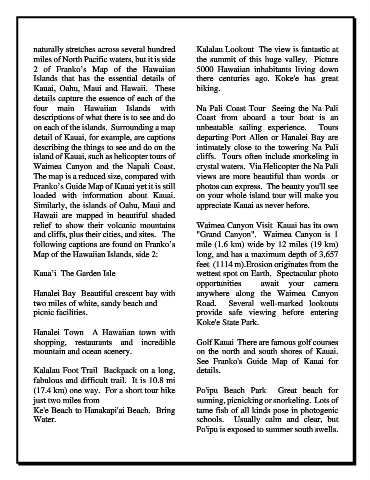
naturally stretches across several hundred            Kalalau Lookout  The view is fantastic at
            miles of North Pacific waters, but it is side         the summit of this huge valley.  Picture
            2 of Franko’s Map of the Hawaiian                     5000 Hawaiian inhabitants living down
            Islands that has the essential details of             there centuries ago.  Koke'e  has great
            Kauai, Oahu, Maui  and Hawaii.  These                 hiking.
            details capture the essence of each of the
            four main Hawaiian Islands with                       Na Pali Coast Tour  Seeing the Na Pali
            descriptions of what there is to see and do           Coast from aboard a tour boat is an
            on each of the islands.  Surrounding a map            unbeatable  sailing experience.   Tours
            detail of Kauai, for example, are captions            departing Port Allen or Hanalei Bay are
            describing the things to see and do on the            intimately close to the towering Na Pali
            island of Kauai, such as helicopter tours of          cliffs.  Tours often include snorkeling in
            Waimea  Canyon and the Napali Coast.                  crystal waters.  Via Helicopter the Na Pali
            The map is a reduced size, compared with              views are more beautiful than words  or
            Franko’s Guide Map of Kauai yet it is still           photos can express.  The beauty you'll see
            loaded with information about Kauai.                  on your whole island tour will make you
            Similarly, the islands of Oahu, Maui and              appreciate Kauai as never before.
            Hawaii  are  mapped  in  beautiful  shaded
            relief  to show  their  volcanic  mountains           Waimea Canyon Visit  Kauai has its own
            and cliffs, plus their cities, and sites.   The       "Grand Canyon".   Waimea  Canyon is 1
            following captions are found on Franko’s              mile (1.6 km) wide by 12 miles (19 km)
            Map of the Hawaiian Islands, side 2:                  long, and has a maximum depth of 3,657
                                                                  feet  (1114 m).Erosion originates from the
            Kaua’i  The Garden Isle                               wettest spot on Earth.  Spectacular photo
                                                                  opportunities   await your camera
            Hanalei Bay  Beautiful crescent bay with              anywhere along the Waimea Canyon
            two miles of white, sandy beach and                   Road.    Several  well-marked  lookouts
            picnic facilities.                                    provide safe viewing before entering
                                                                  Koke'e State Park.
            Hanalei Town  A  Hawaiian  town with
            shopping,  restaurants and incredible                 Golf Kauai  There are famous golf courses
            mountain and ocean scenery.                           on the north and south shores of Kauai.
                                                                  See Franko's Guide Map of  Kauai for
            Kalalau Foot Trail  Backpack on a long,               details.
            fabulous and difficult trail.  It is 10.8 mi
            (17.4 km) one way.  For a short tour hike             Po'ipu Beach Park  Great  beach for
            just two miles from                                   sunning, picnicking or snorkeling.  Lots of
            Ke'e Beach to Hanakapi'ai Beach.  Bring               tame fish of all kinds pose in photogenic
            Water.                                                schools.   Usually calm  and clear, but
                                                                  Po'ipu is exposed to summer south swells.