
Page 82 - eProceeding - IRSTC & RESPEX 2017
P. 82
Che Ku Ahmad Fuad bin Che Ku Abdullah / JOJAPS – JOURNAL ONLINE JARINGAN COT POLIPD
Latest TLS not only generate 3D data, even now are able to capture four-dimensions (4D) data which is 3D space data plus
time (Kromer et al., 2015), since the reflected laser beam can detect the amplitude or intensity of the laser beam. TLS is a
‘ground-based’ instrument used to scan various object from small monument until to the very large building. The laser scanner
technology is a quickly tool of scanning an object by recording the shape and surface to visualize the object in RGB points cloud
information (Lerma et al., 2014). Three main types of methods for Terrestrial Laser Scanner are Time of Flight (TOF), Phase
Shift and Triangulation Based System (Schulz, 2007). However, Phase Shift and Triangulation Based system rarely used in
Terrestrial Laser Scanner compared with the Time of Flight (TOF) method.
The conventional method is still used on measurement and mapping but is rarely to perform in 3D model. As-built plans are
normally required by the construction management for the purpose of monitoring the progress of work and the payment of
claims. The TLS technology can encourage surveyor to collecting data and perform the data in 3D model In short time and the
3D model can give better information with good visualization. In addition, it is sometimes difficult to detect and record changes
based on decisions made during construction time and thus can produce a final product that deviates from the state as designed.
This study will conducted for the purpose of implementing new technology in the as-built work process and also can be used as a
database that for further study whether to review the construction work which has been completed, for the in-future development
and construction work and for future reference in case of any accident or disaster.
This study is conducted to generate 3D model of as-built building details from point cloud provided by TLS. Then to
determination the accuracy of as-built model by comparing it to the existing as-design. Therefore, the method of data collection
using TLS and how to generate the 3D model of the building in LOD3 needs to be determined and studied to get good results. As
for this study, Leica ScanStation C10 is used in data acquisition on field. Leica ScanStation C10 represents the most capabilities
and best value packed into a single laser scanner instrument. It is includes scanner, auto-adjusting camera, battery, tilt sensor,
data storage, and plummet laser on the instrument. Then cloud data from the TLS tool will be processed using the Cyclone
software for registration purposes. It will then be displayed in the form of RGB data model or point cloud intensity.
To generate the data in 3D model, SketchUp Pro 2016 software is choose because it is very user friendly and suitable to use
for points cloud data in generate 3D model. To ensure that the results obtained meet the required accuracy, quantitative accuracy
assessment of dimensional measurement data of the building was carried out. Thus, hypothesis test results obtained are shown in
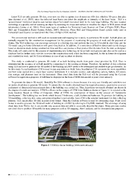
the chapter of results and analysis. UTM Eco-Home on the campus of UTM Johor Bahru as shown in Figure 1.1 is selected as the
study location. Based on Office of Corporate Affair of UTM, the construction of house on the concept of "Sustainable
Development". The building has two levels which located 3 bedrooms, a hall, kitchen and bathroom. To generate the building in
3D modelling, collecting data using conventional method is not suitable. Leica C10 is the selected instrument for data collecting
purpose. TLS can produce 3D data in point cloud format. Then the Cyclone software is used for processing stage. Point cloud
format is used to generate the 3D detail model of building in a LOD3 by referring to CityGML standard. The advantage of using
cloud data from TLS is that it can provide very accurate data and able to accurately describe the object. Many previous studies
use cloud data to produce 3D models for many purposes such as 3D mapping, object analysis, and for documentation purposes.
Figure 1: UTM Eco-home building (www.news.utm.my)
80 | V O L 7 - I R S T C 2 0 1 7 & R E S P E X 2 0 1 7