
Page 86 - Demo
P. 86
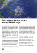
The Caribbean Weather Impacts Group (CARIWIG) project
Various groups within the Caribbean, including those who make policy, require information on what the future climate may be and how it may impact their location. This information is needed for short term the 2030s, for example) and long term (for example, the 2080s) planning. Therefore, the Caribbean Weather Impacts Group (CARIWIG) Project did three things:
1. The project team met with regional groups to find out the climate information they require to help them determine how climate change will affect them. This process would help the groups identify possible actions they may need to take. The groups were from water, agriculture and coastal protection sectors.
2. The project team developed a simple interactive web interface that provides users with easy online access to Caribbean data.
3. Theprojectteammetasecondtimewithregionalgroupsto show the usefulness of climate information to decision making, and to provide training on the use of the web interface.
The project team included the University of the West Indies (Climate Studies Group, Mona, Jamaica), Caribbean Community Climate Change Center (Belize), Newcastle University (United Kingdom), the University of East Anglia (United Kingdom), and the Institute of Meteorology (Cuba). The project was funded by the Climate and Development Knowledge Network (CDKN).
The web portal that was developed provides access to a number of climate tools created or adapted under the project. The portal is
simple, data driven, and interactive, and facilitates the setting of different scenarios that allow for planning and decision making. The Climate Studies Group, Mona participated by creating the Simple Model for Advection of Storms and Hurricanes (SMASH). SMASH is a model that allows planners and decision makers the opportunity to set different hurricane tracks and intensities, and provides their rainfall rates and wind speeds on a 25km grid for any location on the island of interest. It is UWI’s contribution to the set of climate tools developed under the CARIWIG Project. SMASH works by allowing the user to first choose historical hurricanes of significance to the region (for example, Dean,
There is potential to use the tools for activities to create awareness of flooding from different types of tracks and speeds of hurricanes, and towards better planning to avoid loss of life and property.
86
107
Recognising Outstanding Researchers 2016
