
Page 11 - December 2019
P. 11
Two types of aerial photos were taken – vertical,
employing a single directly downward looking
camera, and trimet, utilizing a combination of three
cameras – one pointed vertically downward and the
other two mounted obliquely pointed in directions
perpendicular to the direction of flight. The trimet
system, through simultaneous exposures, enabled
photographs from horizon to horizon of narrow
strips of ground. This enabled the coverage from a
single flight line to be greatly expanded, thus
requiring fewer flight lines when photographing vast
expanses of territory.
Mapping the Canadian North – Post WWII The season for aerial photography in the Canadian
By Neil Taylor
North was short since ground needed to be free of
Prior to the Second World War, one of the principal ice and snow, and it could be further hampered by
responsibilities of the Canadian Air Force was aerial cloud cover and smoke from forest fires. The small
photography. It was a slow process, given the aircraft airplanes were unable to cover much territory so in
and camera equipment of the times, and during the 1946 the Ansons were phased out and the Mitchells
entire period from 1921 to 1939 only 868,600 square along with a few Lancasters assumed the lion’s share
miles of territory were covered. With the advent of the of the work.
war, domestic aerial photography for mapping purposes
was discontinued. That same year, a very controversial program of the
United States Army Air Forces, called Operation
As the war wound down, the RCAF moved to re-
Polaris, began in the Canadian Arctic. It involved
implement its aerial mapping program, paying particular three round trips per week between Meeks Field,
attention to the Canadian North where accurate
Iceland and Ladd Field, Alaska for the purpose of
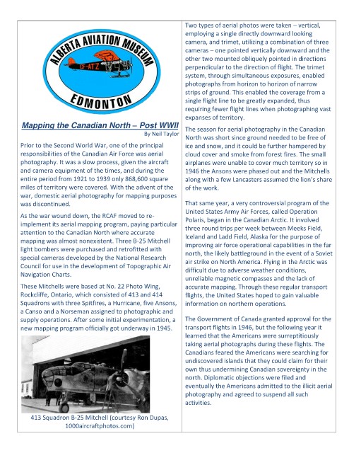
mapping was almost nonexistent. Three B-25 Mitchell
improving air force operational capabilities in the far
light bombers were purchased and retrofitted with north, the likely battleground in the event of a Soviet
special cameras developed by the National Research
air strike on North America. Flying in the Arctic was
Council for use in the development of Topographic Air
difficult due to adverse weather conditions,
Navigation Charts.
unreliable magnetic compasses and the lack of
These Mitchells were based at No. 22 Photo Wing, accurate mapping. Through these regular transport
Rockcliffe, Ontario, which consisted of 413 and 414 flights, the United States hoped to gain valuable
Squadrons with three Spitfires, a Hurricane, five Ansons, information on northern operations.
a Canso and a Norseman assigned to photographic and
supply operations. After some initial experimentation, a The Government of Canada granted approval for the
new mapping program officially got underway in 1945. transport flights in 1946, but the following year it
learned that the Americans were surreptitiously
taking aerial photographs during these flights. The
Canadians feared the Americans were searching for
undiscovered islands that they could claim for their
own thus undermining Canadian sovereignty in the
north. Diplomatic objections were filed and
eventually the Americans admitted to the illicit aerial
photography and agreed to suspend all such
activities.
413 Squadron B-25 Mitchell (courtesy Ron Dupas,
1000aircraftphotos.com)