
Page 12 - December 2019
P. 12
By the end of the 1950-51 photo season, the RCAF
had surveyed the vast majority of the Canadian
North. The Lancasters of 408 Squadron, and later
commercial operators, would continue to fill gaps in
the aerial coverage, but increasingly the squadron’s
attention turned to Cold War northern
reconnaissance patrols aimed at monitoring Soviet
activity in the Arctic and collecting atmospheric
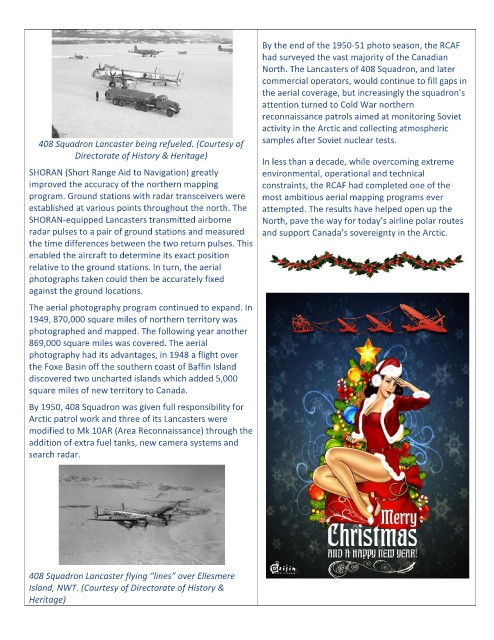
408 Squadron Lancaster being refueled. (Courtesy of samples after Soviet nuclear tests.
Directorate of History & Heritage)
In less than a decade, while overcoming extreme
SHORAN (Short Range Aid to Navigation) greatly environmental, operational and technical
improved the accuracy of the northern mapping constraints, the RCAF had completed one of the
program. Ground stations with radar transceivers were most ambitious aerial mapping programs ever
established at various points throughout the north. The attempted. The results have helped open up the
SHORAN-equipped Lancasters transmitted airborne North, pave the way for today’s airline polar routes
radar pulses to a pair of ground stations and measured and support Canada’s sovereignty in the Arctic.
the time differences between the two return pulses. This
enabled the aircraft to determine its exact position
relative to the ground stations. In turn, the aerial
photographs taken could then be accurately fixed
against the ground locations.
The aerial photography program continued to expand. In
1949, 870,000 square miles of northern territory was
photographed and mapped. The following year another
869,000 square miles was covered. The aerial
photography had its advantages, in 1948 a flight over
the Foxe Basin off the southern coast of Baffin Island
discovered two uncharted islands which added 5,000
square miles of new territory to Canada.
By 1950, 408 Squadron was given full responsibility for
Arctic patrol work and three of its Lancasters were
modified to Mk 10AR (Area Reconnaissance) through the
addition of extra fuel tanks, new camera systems and
search radar.
408 Squadron Lancaster flying “lines” over Ellesmere
Island, NWT. (Courtesy of Directorate of History &
Heritage)