
Page 5 - Skymap
P. 5
5
SURVEYING & MAPPING MINING, QUARRIES &
AGGREGATES
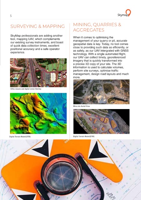
Industries SkyMap professionals are adding another When it comes to optimising the
tool, mapping UAV, which complements
our existing survey instruments, and boast management of your quarry or pit, accurate
geospatial data is key. Today, no tool comes
of quick data collection times, excellent close to providing such data as efficiently, or
positional accuracy and a safe operator
The detailed and geo-accurate data that our UAV provide is today adding value to numerous experience. as safely, as our UAV intergrated with GNSS
industries from the creation of new cadastral layers, as-built construction surveys and stockpile technology. With a single automated flight,
measurement to bridge inspection, animal population surveys and flood prevention planning our UAV can collect timely, georeferenced
imagery that is quickly transformed into
a precise 3D copy of your site. The 3D
information is used to calculate volumes,
perform site surveys, optimise traffic
management, design road layouts and much
more.
Ortho-mosaic and digital vector Overlay
SURVEYING & MINING, QUARRIES ENGINEERING &
MAPPING & AGGREGATES CONSTRUCTION
Mine site Aerial View
AGRICULTURE ENVIRONMENTAL ARCHITECTURAL
PROTECTION SURVEY
Digital Terrain Model(DTM) Digital Terrain Model(DTM)