
Page 65 - Green - Maritime Archaeology: A Technical Handbook. 2nd ed
P. 65
a
b
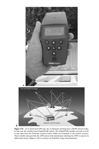
Figure 3.14 (a) A hand-held GPS unit. (b) A schematic showing how a DGPS system works, in this case the satellite-based OmniSTAR system. The OmniSTAR satellite (second on left) is sent data from the Network Control Center which are broadcast to the remote receiver. These satellite data provide the GPS system with information allowing the GPS to operate in differential mode. (Figure 3.14b is courtesy of OmniStar, Fugro International.)
