
Page 2 - Topic 1 - introduction to gis
P. 2
Geographic information system(GIS): is a system designed to capture, store,
manipulate, analyze, manage, and present spatial or geographic data. GIS
applications are tools that allow users to create interactive queries (user-created
searches), analyze spatial information, edit data in maps.
ArcMap is the main application used in ArcGIS for Desktop for mapping, editing,
analysis, and data management. ArcMap is used for all 2D mapping work and
visualization.
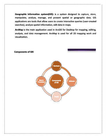
Components of GIS
Hardware
Data & Components
Procedure of GIS Software
People