
Page 6 - Topic 1 - introduction to gis
P. 6
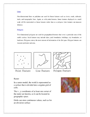
Lines


                        One-dimensional  lines  or  polylines  are  used  for  linear  features  such  as  rivers,  roads,  railroads,

                        trails,  and  topographic  lines.  Again,  as  with  point  features,  linear  features  displayed  at  a  small
                        scale will be represented as linear features rather than as a polygon. Line features can measure
                        distance.


                        Polygons


                        Two-dimensional polygons are used for geographical features that cover a particular area of the

                        earth's surface. Such features may include lakes, park boundaries, buildings, city boundaries, or
                        land uses. Polygons convey the most amount of information of the file types. Polygon features can

                        measure perimeter and area.


                    Raster

                    In a raster model, the world is represented as
                    a surface that is divided into a regular grid of
                    cells.

                    The x , y coordinates of at least one corner of
                    the raster are known, so it can be located in

                    geographic space.

                    Grids can store continuous values, such as for
                    an elevation surface