Page 309 - demo
P. 309
Continuing on from the Vindolanda turn-off . . .


        1.5 mi  54.9965,  -2.2387 At the i/s with the B6318.  The Sill National Landscape Discovery
        Centre. This facility, at this intersection,  explores and illustrates the landforms and landscapes of
        Britain’s national parks and in particular Northumberland National Park. It includes a youth hostel.

        Where to from here?

        You now have a choice of either (or both) of two Hadrian’s Wall sites. By turning right you can go
        directly north and along the way take a walk up to Houseteads Fort.  But be advised it’s a solid 20
        minute climb from the car-park.

        On the other hand, by turning left for Birdoswald Roman Fort, you can get a much better wall
        experience without the long hard slog uphill. That is my recommendation. It’s one of the best parts
        of the Hadrian’s Wall experience.

        For Birdoswald:


        At the i/s with the B6318 turn l. on to the B6318 s/p “Cawfields 21/4 / Roman Army Museum  5”
        and “Carlisle / Greenhead / B6318”.

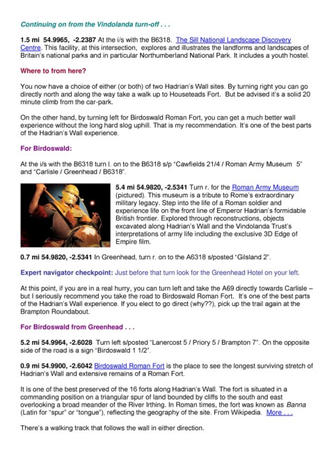
                                          5.4 mi 54.9820, -2.5341 Turn r. for the Roman Army Museum
                                          (pictured). This museum is a tribute to Rome’s extraordinary
                                          military legacy. Step into the life of a Roman soldier and
                                          experience life on the front line of Emperor Hadrian’s formidable
                                          British frontier. Explored through reconstructions, objects
                                          excavated along Hadrian’s Wall and the Vindolanda Trust’s
                                          interpretations of army life including the exclusive 3D Edge of
                                          Empire film.

        0.7 mi 54.9820, -2.5341 In Greenhead, turn r. on to the A6318 s/posted “Gilsland 2”.


        Expert navigator checkpoint: Just before that turn look for the Greenhead Hotel on your left.

        At this point, if you are in a real hurry, you can turn left and take the A69 directly towards Carlisle –
        but I seriously recommend you take the road to Birdoswald Roman Fort.  It’s one of the best parts
        of the Hadrian’s Wall experience. If you elect to go direct (why??), pick up the trail again at the
        Brampton Roundabout.

        For Birdoswald from Greenhead . . .


        5.2 mi 54.9964, -2.6028  Turn left s/posted “Lanercost 5 / Priory 5 / Brampton 7”. On the opposite
        side of the road is a sign “Birdoswald 1 1/2”.


        0.9 mi 54.9900, -2.6042 Birdoswald Roman Fort is the place to see the longest surviving stretch of
        Hadrian’s Wall and extensive remains of a Roman Fort.


        It is one of the best preserved of the 16 forts along Hadrian’s Wall. The fort is situated in a
        commanding position on a triangular spur of land bounded by cliffs to the south and east
        overlooking a broad meander of the River Irthing. In Roman times, the fort was known as Banna
        (Latin for “spur” or “tongue”), reflecting the geography of the site. From Wikipedia.  More . . .


        There’s a walking track that follows the wall in either direction.

