Page 418 - Geosystems An Introduction to Physical Geography 4th Canadian Edition
P. 418
 13
 concepts
KEy LEARNINg
 Tectonics, Earthquakes, and Volcanism
  After reading the chapter, you should be able to:
• Describe first, second, and third orders of relief, and list Earth’s six major topographic regions.
• Describe the formation of continental crust, and define displaced terranes.
• Explain the process of folding, and describe the principal types of faults and
their characteristic landforms.
• List the three types of plate collisions associated with orogenesis, and identify specific examples of each.
• Explain earthquake characteristics and measurement, describe earthquake fault mechanics, and discuss the status of earthquake forecasting.
• Describe volcanic landforms, and distinguish between an effusive and an ex- plosive volcanic eruption.
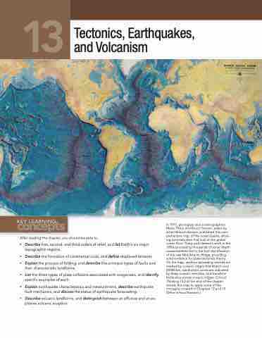
In 1977, geologists and oceanographers Marie Tharp and Bruce Heezen, aided by artist Heinrich Berann, published this com- prehensive map of the ocean basins, allow- ing scientists their first look at the global ocean floor. Tharp and Heezen’s work in the 1950s processing thousands of sonar depth measurements led to the first identification of the vast Mid-Atlantic Ridge, providing solid evidence for plate tectonics theory. On the map, seafloor spreading centres are marked by oceanic ridges that stretch over 64 000 km, subduction zones are indicated by deep oceanic trenches, and transform faults slice across oceanic ridges. Critical Thinking 13.2 at the end of the chapter revisits this map to apply some of the concepts covered in Chapters 12 and 13. [Office of Naval Research.]


