Page 495 - Geosystems An Introduction to Physical Geography 4th Canadian Edition
P. 495
Chapter 15 River Systems 459
   CRITICALthinking 15.2 Identifying Drainage Patterns
Examine the photograph in Figure CT 15.2.1, where you see two distinct drainage patterns. Of the seven types il- lustrated in Figure 15.5, which two patterns are most like those in the aerial photo? Looking back to Figure 15.1a, which drainage pattern is prevalent in the area around Mount Mismi in Brazil? Explain your answer. The next time you fly in an airplane, look out the window to observe the various drainage patterns across the landscape. •
▲Figure CT 15.2.1 Two drainage patterns dominate this scene from central Montana, in response to rock structure and local relief. [Bobbé Christopherson.]
  Basic Fluvial Concepts
Gradient
Within its drainage basin, every stream has a degree of inclination or gradient, which is also known as the channel slope. The gradient of a stream is defined as the drop in elevation per unit distance, usually mea- sured in metres per kilometre. Characteristically, a river has a steeper slope nearer the headwaters and a more gradual slope downstream. A stream’s gradient affects its energy and ability to move material; in particular, it affects the velocity of the flow (discussed just ahead).
Base Level
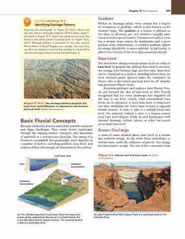
The level below which a stream cannot erode its valley is base level. In general, the ultimate base level is sea level, the average level between high and low tides. Base level can be visualized as a surface extending inland from sea level, inclined gently upward under the continents. In theory, this is the lowest practical level for all denuda- tion processes (Figure 15.6a).
American geologist and explorer John Wesley Pow- ell, put forward the idea of base level in 1875. Powell recognized that not every landscape has degraded all the way to sea level; clearly, other intermediate base levels are in operation. A local base level, or temporary one, may determine the lower limit of local or regional stream erosion. A river or lake is a natural local base level; the reservoir behind a dam is a human-caused local base level (Figure 15.6b). In arid landscapes with internal drainage, valleys, plains, or other low points act as local base level.
Stream Discharge
A mass of water situated above base level in a stream has potential energy. As the water flows downslope, or downstream, under the influence of gravity, this energy becomes kinetic energy. The rate of this conversion from
▼Figure 15.6 Ultimate and local base levels. [(b) Bobbé Christopherson.]
(b) Lake Powell behind Glen Canyon Dam is a local base level on the Colorado River.
Streams, a mixture of water and solids, provide resources and shape landforms. They create fluvial landscapes through the ongoing erosion, transport, and deposition of materials in a downstream direction. The energy of a stream to accomplish this geomorphic work depends on a number of factors, including gradient, base level, and volume of flow (discharge), all discussed in this section.
    Dam
Sediment
Reservoir
Local base level accumulation
 Sediment accumulation
 Ocean
(a) The ultimate base level is sea level. Note how base level curves gently upward from the sea as it is traced inland; this is the theoretical limit for stream erosion. The reservoir behind a dam is a local base level.
l
e
v
e
l
e
as
B
Sea level


