
Page 12 - Garmin Fishfinder Catalog 2021
P. 12
LAKEVÜ INLAND MAPS
featuring
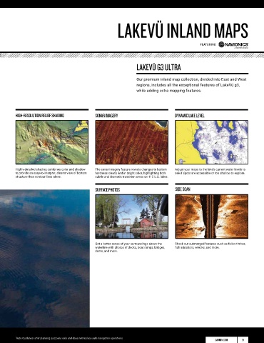
LAKEVÜ G3 ULTRA
Our premium inland map collection, divided into East and West
regions, includes all the exceptional features of LakeVü g3,
while adding extra mapping features.
HIGH-RESOLUTION RELIEF SHADING SONAR IMAGERY DYNAMIC LAKE LEVEL
Highly-detailed shading combines color and shadow The sonar imagery feature reveals changes to bottom Adjust your maps to the lake’s current water levels to
to provide an easy-to-interpret, clearer view of bottom hardness clearly and in bright color, highlighting both see if spots are accessible or too shallow to explore.
structure than contour lines alone. subtle and dramatic transition areas on 115 U.S. lakes.
SURFACE PHOTOS SIDE SCAN
Get a better sense of your surroundings above the Check out submerged features such as fallen timber,
waterline with photos of docks, boat ramps, bridges, fish attractors, wrecks, and more.
dams, and more.
1 Auto Guidance is for planning purposes only and does not replace safe navigation operations
GARMIN.COM 19