
Page 65 - Advanced Bible Geography ebook
P. 65
Geographical Features
Israel may be divided into four geographical regions: three parallel strips running north to
south and a large, mostly arid, zone in the southern half.
The coastal plain runs parallel to the Mediterranean Sea and is composed of a sandy
shoreline, bordered by stretches of fertile farmland extending up to 25 miles (40 km.)
inland.
In the North, expanses of sandy beach are occasionally punctuated by jagged chalk and sandstone cliffs.
The coastal plain is home to more than half of Israel's 7 million people and includes major urban centers,
deep-water harbors, most of the country's industry, and a large part of its agriculture and tourist
facilities.
Several mountain ranges run the length of
the country. In the northeast, the basalt
landscapes of the Golan Heights, formed by
volcanic eruptions in the distant past, rise as
steep cliffs overlooking the Hula Valley.
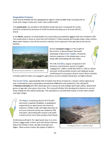
The hills of Galilee, largely composed of soft
limestone and dolomite, ascend to heights
ranging from 1,600 to 4,000 feet (500 to 1,200 m.) above
Mount Hermon (Photo: S. Lederhendler) sea level. Small perennial streams and relatively ample
rainfall keep the area green all year round. Many residents
of Galilee and the Golan are engaged in agriculture, tourism-related enterprises, and light industry.
The Jezreel Valley, separating the hills of Galilee from those of Samaria, is Israel's richest agricultural
area, cultivated by many cooperative communities (kibbutzim and moshavim). The rolling hills
of Samaria and Judea (the West Bank) present a mosaic of rocky hilltops and fertile valleys, dotted with
groves of age-old, silver-green olive trees. The terraced hillsides, first developed by farmers in ancient
times, blend into the natural landscape. The population is concentrated mainly in small urban centers
and large villages.
The Negev, comprising about half of Israel's
land area, is sparsely inhabited, its population
supported by an agricultural and industrial
economy. Further south, the Negev becomes an
arid zone characterized by low sandstone hills
and plains, abounding with canyons and wadis
in which winter rains often produce flash floods.
Continuing southward, the region gives way to an area
of bare craggy peaks, craters, and rock-strewn plateaus,
where the climate is drier, and the mountains are The Negev (Photo: S. Lederhendler)
higher. Three erosive craters, the largest of which is
63