
Page 38 - Ranger Demo
P. 38
depicted coins which he had found on the ground, or which he had been shown in the collections of local enthusiasts. His fair sheets also include careful plans of ancient sites, and it is highly likely that Henryson and Thompson had shared a classical education and were only too willing to add this element to their topographical task.
'an excellent work, of considerable value'
In April 1815 Penrose forwarded the first sheets of the survey to the Secretary to the Admiralty Board, reporting that 'the celebrated Piazzi, as well as the officers of engineers, and all other judges, give ample testimony to the extreme
accuracy of the observations
and calculations of Lieutenant Smyth'.24 Hurd lost no time in writing to the First Lord with a glowing encomium for this 'ingenious and very valuable officer' with 'very superior talents' and the prospect of 'future scientific exertions' delivering 'everything useful to navigation, and beneficial to the Naval service of this country.25 John Wilson Croker, the First Secretary, was already considering Smyth's employment on a 'survey of the Morea, Archipelago, etc.'. The clerks were directed to draft a reply to Smyth expressing the Board's appreciation of his efforts 'in consequence of which he has been promoted to the rank of Commander'.26
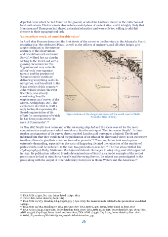
In May 1817 Smyth took command of the surveying ship Aid and the scene was set for the more comprehensive employment which would earn him the sobriquet "Mediterranean Smyth". In June further consignments of his survey sheets reached London and were much admired. The Board informed him that they would fund the publication of an atlas of his charts and views 'as an incitement to other officers to give their attention to similar pursuits'.27 The compilation task was to prove extremely demanding, especially as the costs of Engraving dictated the reduction of the number of plates which could be included. In the end, two publications resulted.28 The fine atlas entitled The Hydrography of Sicily, Malta and the Adjacent Islands: Surveyed in 1814, 1815, and 1816 appeared in 1823. Its publication reflected Hurd's determined use of Smyth as a model example of the sort of practitioner he had in mind for a Royal Naval Surveying Service. Its advent was promulgated in the press along with the output of other Admiralty Surveyors in Home Waters and the Americas.29
24 TNA ADM 1/430, No. 102, letter dated 11 Apr. 1815
25 UKHO LB1, letter dated 13 Sept. 1815
26 TNA ADM 12/173, Heading 68.4, Cap S 533, 7 Apr. 1815; the Board minute related to his promotion was dated 14 Sept.
27 TNA ADM 12/184, Heading 57, N55, 10 June 1817; TNA ADM 1/436, N69a, letter dated 15 Sept. 1817
28 TNA ADM 1/2545, Cap S 266, letter dated 30 Sept. 1817; TNA ADM 1/437 N18, letter dated 18 Jan. 1819; TNA ADM 1/2548, Cap S 156, letter dated 26 June 1820; TNA ADM 1/2548, Cap S 229, letter dated 27 Dec. 1820
29 Webb, Expansion of British Hydrographic Administration, 347
Figure 6 Some of the dangerous shoals off the south coast of Sicily. From the Atlas of Sicily
36
