
Page 17 - CPM Sri Lanka-Chartered Manager-Sept. 2021
P. 17
THE INSTITUTE OF CHARTERED PROFESSIONAL MANAGERS OF SRI LANKA
JANUARY 2021
Reclamation of land from the sea has been widely It is important to note that the use of rock
used across the world for several decades. Whilst low- has been minimized by the use of an offshore
lying countries such as the Netherlands and Indonesia breakwater, based on sand and concrete armour
have viewed it as a solution to tackle flooding caused blocks. The breakwater construction was
by rising sea levels, the densely populated city states reinforced by multiple layers of material including
of Singapore and Hong Kong have used reclaimed sand, rocks, rubble stone, quarry run and 42,000
land to accommodate a growing population and pieces of Chinese pods.
commercial activities. On the other hand, the Palm
Jumeirah of Dubai is among the world’s most Dredging was carried out with adequate
exclusive tourist and lifestyle destinations. environmental safeguards
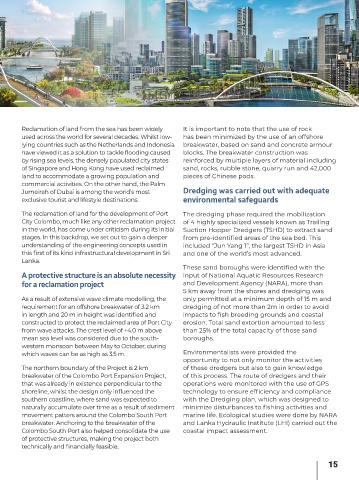
The reclamation of land for the development of Port The dredging phase required the mobilization
City Colombo, much like any other reclamation project of 4 highly specialized vessels known as Trailing
in the world, has come under criticism during its initial Suction Hopper Dredgers (TSHD) to extract sand
stages. In this backdrop, we set out to gain a deeper from pre-identified areas of the sea bed. This
understanding of the engineering concepts used in included “Jun Yang 1”, the largest TSHD in Asia
this first of its kind infrastructural development in Sri and one of the world’s most advanced.
Lanka.
These sand boroughs were identified with the
A protective structure is an absolute necessity input of National Aquatic Resources Research
for a reclamation project and Development Agency (NARA), more than
5 km away from the shores and dredging was
As a result of extensive wave climate modelling, the only permitted at a minimum depth of 15 m and
requirement for an offshore breakwater of 3.2 km dredging of not more than 2m in order to avoid
in length and 20 m in height was identified and impacts to fish breeding grounds and coastal
constructed to protect the reclaimed area of Port City erosion. Total sand extortion amounted to less
from wave attacks. The crest level of +4.0 m above than 25% of the total capacity of those sand
mean sea level was considered due to the south- boroughs.
western monsoon between May to October, during
which waves can be as high as 3.5 m. Environmentalists were provided the
opportunity to not only monitor the activities
The northern boundary of the Project is 2 km of these dredgers but also to gain knowledge
breakwater of the Colombo Port Expansion Project, of this process. The route of dredgers and their
that was already in existence perpendicular to the operations were monitored with the use of GPS
shoreline, whilst the design only influenced the technology to ensure efficiency and compliance
southern coastline, where sand was expected to with the Dredging plan, which was designed to
naturally accumulate over time as a result of sediment minimize disturbances to fishing activities and
movement patters around the Colombo South Port marine life. Ecological studies were done by NARA
breakwater. Anchoring to the breakwater of the and Lanka Hydraulic Institute (LHI) carried out the
Colombo South Port also helped consolidate the use coastal impact assessment.
of protective structures, making the project both
technically and financially feasible.
15