
Page 203 - International Space Station Benefits for Humanity, 3rd edition.
P. 203
Disaster Response
Remotely sensed data acquired by orbital sensor systems has emerged as a vital tool to identify
the extent of damage resulting from a natural disaster, as well as providing near-real time mapping
support to response efforts on the ground and humanitarian aid efforts. The International Space
Station (ISS) is a unique terrestrial remote-sensing platform for acquiring disaster-response imagery.
Unlike automated remote-sensing platforms it has a human crew; is equipped with both internal and
externally mounted still and video imaging systems; and has an inclined, low-Earth orbit that provides
variable views and lighting (day and night) over 95 percent of the inhabited surface of the Earth.
As such, it provides a useful complement to autonomous sensor systems in higher-altitude polar
orbits for collecting imagery in support of disaster response.
Clear High-definition Images Aid platform is used for research in diverse areas such
Disaster Response as communications, space science, engineering,
technology demonstration, materials processing
Data collected from various ISS (https://www.nasa. and Earth observation.
gov/mission_pages/station/research/overview.
html) sensor systems have contributed to Earth SS-HDTV was developed to take night images
observation and disaster response through of the Earth, including such phenomena as aurora,
international collaboration frameworks such as airglow and meteor showers. It is operated in the ISS
the International Charter, Space and Major Disasters pressurized module cabin including the JEM and the
(http://www.disasterscharter.org/home) and Sentinel Cupola Observational Module. The beautiful night
Asia (http://www.jaxa.jp/article/special/sentinel_ images are utilized for the check of the electric power
asia/index_e.html). The Japanese Experiment Module restoration, the revival of cities after a natural disaster,
(JEM), or Kibo, provides opportunities to obtain very and the return to normal life for those people affected.
clear high-definition (HD) images both from internal Images of the Earth’s surface, oceans, clouds, etc.,
handheld cameras and from externally mounted are taken from the space station for disaster response,
cameras. These clear images are beneficial for education and publicity purposes.
disaster support.
HDTV-EF2 also provides the Earth surface images
The Japan Aerospace Exploration Agency (JAXA) with 4k high resolution on demand from Sentinel Asia,
offers data taken with two camera systems: the Super although its main purpose is to demonstrate that the
Sensitive HD Television (SS-HDTV) Camera System commercial products can normally operate, for a long
and the High Definition TV Camera - Exposed Facility period of time, in the space environment. Sentinel Asia
2 (HDTV-EF2) mounted on JEM Kibo Exposed Facility aims to promote international cooperation to monitor
(JEM-EF). JEM-EF is an unpressurized, multipurpose natural disasters in the Asia-Pacific region. According
pallet structure attached to the JEM. This external to statistics by the Asian Disaster Reduction Center’s
Natural Disasters Data Book 2013, Asia accounts
for 44.6 percent of occurrences; 84.6 percent of
people killed; 87.1 percent of affected people; and
49.0 percent of economic damage. Under these
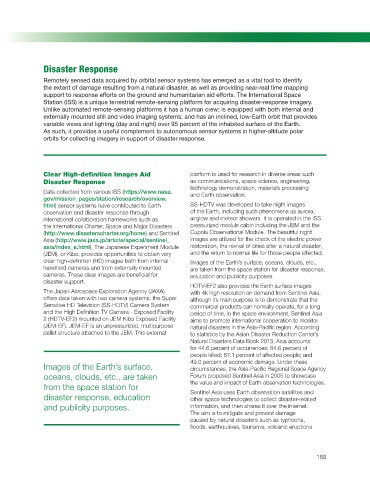
Images of the Earth’s surface, circumstances, the Asia-Pacific Regional Space Agency
oceans, clouds, etc., are taken Forum proposed Sentinel Asia in 2005 to showcase
from the space station for the value and impact of Earth observation technologies.
Sentinel Asia uses Earth observation satellites and
disaster response, education other space technologies to collect disaster-related
and publicity purposes. information, and then shares it over the internet.
The aim is to mitigate and prevent damage
caused by natural disasters such as typhoons,
floods, earthquakes, tsunamis, volcanic eruptions
189