
Page 13 - MathCounts 2018 - Final Draft for Publishing
P. 13
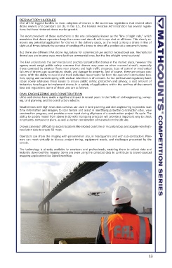
REGULATORY HURDLES
          One  of  the  biggest  hurdles  to  mass  adoption  of  drones  is  the  numerous  regulations  that  restrict  what
          drone owners and operators can do. In the U.S., the Federal Aviation Administration has several regula-
          tions that have hindered drone market growth.
          The most prevalent of these restrictions is the one colloquially known as the "line of sight rule," which
          mandates that drone operators keep the unmanned aircraft within eye shot at all times. This clearly re-
          moves any potential application for drones in the delivery space, as the need to keep a drone in line of
          sight at all times defeats the purpose of sending off a drone to drop off a product at a consumer's home.
          But there are different FAA drone regulations for commercial use and for recreational use. Recreational
          drone laws are in some ways more lax than commercial ones, but the line of sight remains pivotal.
          The FAA understands the commercial and practical potential for drones in the market place, however the
          agency  must  weigh  public  safety  concerns  that  drones  may  pose  on  other  manned  aircraft,  especially
          those operated by amateur flyers near airports and high traffic airspaces. Loss of control or mechanical
          failures of drones can cause injury, death, and damage to property. And of course, there are privacy con-
          cerns. With the ability to record and track individual movements far from the operator’s immediate loca-
          tion, spying and eavesdropping with unclear intentions is of concern. As the political and regulatory land-
          scape  slowly  addresses  these  issues  to  ensure  public  safety,  protection  and  privacy,  a  vast  amount  of
          industries have begun to implement drones in a variety of applications within the confines of the current
          laws and regulations. Some of these uses are as follows:
          CIVIL ENGINEERING AND CONSTRUCTION
          UAVs and drones have made a significant impact in recent years in the fields of civil engineering, survey-
          ing, land planning, and the construction industry.
          Small drones with high resolution cameras are used in land planning and civil engineering to provide real-
          time information and imagery to scan terrain and assist in identifying potential construction sites, view
          construction progress, and provides a new input during all phases of a construction project life cycle. The
          ability to quickly model from above in 3D with increasing precision will provide a important way to check
          on projects, compare to plans, as well as better coordination of materials on the job site.
          Drones can reach difficult-to-access locations like eroded coastline or mountaintops and acquire very high-
          resolution data to create 3D maps.
          Operators can share the imaging with personnel on site, in headquarters and with sub-contractors. Plan-
          ners  can  meet  virtually  to  discuss  project  timing,  equipment  needs,  and  challenges  presented  by  the
          terrain.
          The  technology  is  already  available  to  amateurs  and  professionals,  enabling  them  to  collect  data  and
          instantly download the imagery. Some are even using the collected data to contribute to crowd-sourced
          mapping applications like OpenStreetMap.


                                                                      13