
Page 12 - Consolidated Catalog
P. 12
AUTOMATED MONITORING
Automated Data Management For contractors/architects informed about
Risk Assessment continued performance of structures under
Encardio Group with partner Moniterra, gradual or sudden changes to their state.
Europe, offers comprehensive geotechnical Encardio Group has great expertise in this
monitoring and geodetic survey services which field, and has executed a number of projects in
can be summarized as follows: Gulf countries and worldwide.
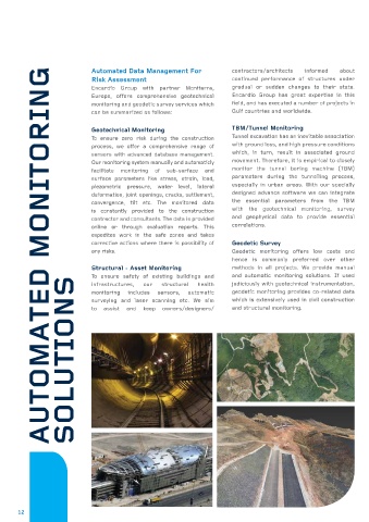
Geotechnical Monitoring TBM/Tunnel Monitoring
To ensure zero risk during the construction Tunnel excavation has an inevitable association
process, we offer a comprehensive range of with ground loss, and high pressure conditions
sensors with advanced database management. which, in turn, result in associated ground
Our monitoring system manually and automaticly movement. Therefore, it is empirical to closely
facilitate monitoring of sub-surface and monitor the tunnel boring machine (TBM)
surface parameters like stress, strain, load, parameters during the tunnelling process,
piezometric pressure, water level, lateral especially in urban areas. With our specially
deformation, joint openings, cracks, settlement, designed advance software we can integrate
convergence, tilt etc. The monitored data the essential parameters from the TBM
is constantly provided to the construction with the geotechnical monitoring, survey
contractor and consultants. The data is provided and geophysical data to provide essential
online or through evaluation reports. This correlations.
expedites work in the safe zones and takes
corrective actions where there is possibility of Geodetic Survey
any risks. Geodetic monitoring offers low costs and
hence is commonly preferred over other
Structural - Asset Monitoring methods in all projects. We provide manual
To ensure safety of existing buildings and and automatic monitoring solutions. If used
SOLUTIONS
infrastructures, our structural health judiciously with geotechnical instrumentation,
monitoring includes sensors, automatic geodetic monitoring provides co-related data
surveying and laser scanning etc. We aim which is extensively used in civil construction
to assist and keep owners/designers/ and structural monitoring.
12