
Page 14 - Town of Bedford FY 2018-2019 Budget.pdf
P. 14
&z ϮϬϭϴͲϮϬϭϵ KWd h ' d dKtE K& &KZ ͕ s/Z'/E/
Community Profile
LOCATION AND DESCRIPTION
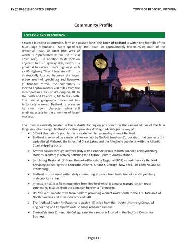
Situated in rolling countryside, farm and pasture land, the Town of Bedford is within the foothills of the
Blue Ridge Mountains. More specifically, the Town lies approximately fifteen miles south of the
definitive Peaks of Otter (the vista of
which is represented within the official
Town seal). In addition to its location
adjacent to US Highway 460, Bedford is
proximal to several major highways such
as US Highway 29 and Interstate 81. It is
strategically located between the larger
urban areas of Lynchburg and Roanoke.
In broader terms, the community is
located approximately 200 miles from the
metropolitan areas of Washington, DC to
the north and Charlotte, NC to the south.
This unique geographic placement has
historically allowed Bedford to preserve
its small town character while still
enabling access to the amenities of larger
markets.
The Town is centrally located in the mid-Atlantic region positioned on the eastern slopes of the Blue
Ridge mountain range. Bedford’s location provides strategic advantages by way of:
¾ 66% of the nation’s population is located within a one day drive of Bedford.
¾ Bedford is serviced by a main rail line owned by Norfolk Southern Corporation that connects the
agricultural Midwest, the industrial Great Lakes and the Allegheny coalfields with the Atlantic
Coast shipping ports.
¾ Amtrak passes through Bedford daily with a connector bus to both Roanoke and Lynchburg
stations. Bedford is actively soliciting for a future Bedford Amtrak station.
¾ Lynchburg Regional (LYH) and Roanoke-Blacksburg Regional (ROA) airports service Bedford
providing direct flights to Charlotte, Atlanta, Orlando, Chicago, New York, Philadelphia and St.
Petersburg.
¾ Bedford is positioned within daily commuting distance from both Roanoke and Lynchburg
metropolitan areas.
¾ Interstate I-81 is a 25-minute drive from Bedford which is a major transportation route
connecting 6 states from the Canadian border to Tennessee.
¾ US 29 is a 19 minute drive from Bedford providing a direct route south to the Tri-State area of
North Carolina and Interstate I-85 and I-40.
¾ The Bedford Center for Business is located 10 miles from the Liberty University School of
Engineering and Computational Sciences research campus.
¾ Central Virginia Community College satellite campus is located in the Bedford Center for
Business.
WĂŐĞ ϭϯ