
Page 60 - SAICE book proof 2 LATEST JULY 2014
P. 60
s a i c e
CHAPTER 4: KwaZulu-Natal Province
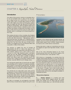
Introduction ◊ Durban Harbour
The name of this province carries an interesting story.
It can be translated freely as place of the Zulu peo-
ple, an Nguni group from central Africa who migrated
to the eastern parts of South Africa during the period
1300–1500. Natal comes from the Portuguese seafarer
Vasco Da Gama who first saw this piece of land from
his ship on 25 December 1497 and called it Natal which
relates to the birth of Christ or Christmas. Before them
the Khoi San peoples inhabited the mountains and the
plains of this province and their rock art is still visible in
secluded caves or overhangs in the Drakensberg Moun-
tain range.
This province borders on three countries, the Kingdom
of Lesotho, Mozambique and Swaziland and also shares
borders with three provinces – Mpumalanga, Eastern
Cape and Free State. Its capital city is Pietermaritzburg, contribute to the commercial and industrial activity. In
still featuring many beautiful red brick colonial buildings addition, the area is quite well supplied with commercial
dating from the time when this was a British colony. forests which supply a host of timber-related products
Durban is the biggest city and the eThekwini Metro has for local as well as international consumption.
a population of about three million.
Durban also hosts a major car manufacturer as well as
The province is roughly the size of Portugal at the biggest car export and importation facility in South
approximately 92 000 m². Only a few places in the Africa.
world can possibly claim that within its borders there are
vast mountain ranges of up to 3 000 m high on which One of the many interesting features is the Prince
it snows in winter, high grassland plains, subtropical Edward graving dock which was the third largest of its
coasts and even the highest vegetated sand dunes in kind in the world when it was opened in 1925.
the world of up to 300 m high. A number of national
wildlife and nature parks are scattered around this With reference to topography, the province hosts the
province and in addition the iSimalingo wetland system majestic Drakensberg Mountains in the south west, the
has been awarded UNESCO world heritage status. continental escarpment to the west and the Lebombos to
the north. Interestingly, about 20 000 years ago the sea
The sub-tropical coastal strip is known for its vast sugar level was about 60 m above its present level and some
cane plantings and for tropical fruit especially bananas, scientists point out that we are in a mini ice age right
which caused it to be known as banana land. The warm now since the seas retreated into ice caps at that time.
Mozambique current is the main cause for this province All along this coast the Berea red dunes bear witness
to attract millions of tourists to its golden beaches. to this event. In Durban much of this ancient edge of
the sea now provides views of the ocean about four
The potential for two deep-water ocean ports and the kilometres away and has been developed extensible for
development of these locations at Durban and Richards residential purposes.
Bay respectively, ensured that the industrial complexes
in these two cities rank in the top five of the country. This province features:
The relatively short corridor of 600 km from Gauteng to
the sea routes of the east, ensure lots of trade. 1. Durban harbour is a bustling port that
serves as South Africa’s biggest general sea cargo
As if this is not enough, the coal deposits in the north facility and handles over 80 million tons per annum.
and the heavy mineral marine deposits along the coast It is able to handle ships up to 564 650-dwt and also
1