
Page 163 - eProceeding - IRSTC & RESPEX 2017
P. 163
Nur Aisah Ab.Moin / JOJAPS – JOURNAL ONLINE JARINGAN COT POLIPD
Various techniques have been used to compare the accuracy of elevation data. From the literature, the DEM from LiDAR
data is considered the best can be achieved with a height of 10-50 cm accuracy with 68% confidence level (ICSM, 2008). LiDAR
is one of the most accurate and effective data collection and the result of comparing visual examination shows that there is a
close similarity between the contours extracted from digital topographic map, IFSAR DEM and LiDAR DEM data (Wan Mohd
Naim Wan Mohd, 2014).
This study discusses the DEM accuracy assesment on difference namely LiDAR data, IFSAR data (airborne) and SRTM data.
Previous studies has conducted to analyse the DEM accuracy assessment of LiDAR, IFSAR and SRTM. The study on LiDAR
has conducted such as accuracy asessment on derived DEM (Aguilar, 2008) and critical isues on LiDAR DEM generation(Liu,
2011). IFSAR has been analyse in the production of digital Cartographic in North Alaska (Garrity, 2004). The comparison
between IFSAR and LIDAR also has conducted in terms of production and acuracy asessment (Mercer, 2001). There are various
of study on analysis of SRTM DEM in methodology and practical results (C. Heipke, 2002).
The derived DEM then will analyse for the hydrological application. Elevation is main driving force of water movement and
due to that DEM are mostly fundamental for all hydrological application (FÜRST, 2002). Since mid-1980s, the era of spatial
modelling in hydrology has begun with DEM and remote sensing data have been used for catchment studies (Nawshin Rumman,
2005). Catchment and sub-catchments can be calculated from DEM and represent surface drainage accurately. The accurate
stream network can be derived from higher resolution of DEM but the highest resolution not necessarily offers the best result
(Thassawan Hanuphab, 2012).
2. Methodology
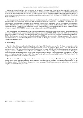
The flow chart of the research methodology is shown in Figure 1.1. Generally, there are four (4) phases or stages involved in
this study. Each phase of the study describes the procedures to achieve the objective of the study. The first phase is the
preliminary study. This stage involves the problem formulation of the study. LiDAR and IFSAR data are acquired from private
company while the SRTM data are downloaded from USGS website. The second phase is data identification. This phase
involves the study of data characteristic i.e the format and the conversion process. Data processing and manipulation is the third
phase involve the producing of surface model, slope map, flow direction and the watershed delineation. The fourth phase is the
analysis for the output results as obtained in the phase 3.
The elevation models are developed from each data and the comparison were analyses. The Outputs are presented graphically
include profile, slope, sub-catchments and stream networks with using ArcGIS software. The output data are analysed for the
hydrological analysis. The final phase discusses the overall accuracy of the different data sources and explains the impact by
using the data for the hydrological works.
161 | V O L 8 - I R S T C 2 0 1 7 & R E S P E X 2 0 1 7