
Page 667 - PPL-engelsk 2025
P. 667
Flight performance and planning
I can print out the weight and balance, as well as the fuel calculation for the trip.
There are wind vanes on the picture, indicating a weak tailwind on the route
section to EKBI.
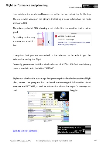
There is a symbol at EKBI showing a red circle. It is the weather that is not so
good.
By clicking on the map
you can see what it is
like.
It requires that you are connected to the internet to be able to get this
information during the flight.
Currently, you can see that there is cloud cover of 5-7/8 at 800 feet, which is why
there is a red circle to the left of "METAR".
SkyDemon also has the advantage that you can print a finished operational flight
plan, where the program has retrieved meteorological information about
weather and NOTAMS, as well as information about the airport's runways and
their lengths.
Back to table of contents
Flyveteori PPL(A)(UL)/LAPL Henning Andersen, Midtjysk Flyveskole© 2025 667