
Page 240 - Divyank Tyagi
P. 240
206 | ChaPter 6 Working With Consultants
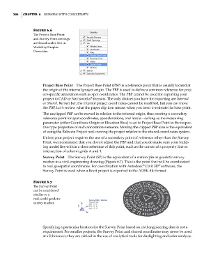
Figure 6.6
The Project Base Point
and survey Point settings
are found under site in
visibility/graphic
overrides.
Project Base Point The Project Base Point (PBP) is a reference point that is usually located at
the origin of the internal project origin. The PBP is used to define a common reference for proj-
ect-specific annotation such as spot coordinates. The PBP cannot be used for exporting your
®
project to CAD or Navisworks formats. The only choices you have for exporting are Internal
or Shared. Remember, the internal project coordinates cannot be modified, but you can move
the PBP. Let’s review what the paper clip icon means when you need to relocate the base point.
The unclipped PBP can be moved in relation to the internal origin, thus creating a secondary
reference point for spot coordinates, spot elevations, and levels—as long as the measuring
parameter (either Coordinate Origin or Elevation Base) is set to Project Base Point in the respec-
tive type properties of such annotation elements. Moving the clipped PBP icon is the equivalent
of using the Relocate Project tool, moving the project relative to the shared coordinates system.
Unless your project requires the use of a secondary point of reference other than the Survey
Point, we recommend that you do not adjust the PBP and that you do make sure your build-
ing model lies within a close reference of this point, such as the corner of a property line or
intersection of column grids A and 1.
Survey Point The Survey Point (SP) is the equivalent of a station pin or geodetic survey
marker in a civil engineering drawing (Figure 6.7). This is the point that will be coordinated
to real geospatial coordinates. For coordination with Autodesk Civil 3D software, the
®
®
Survey Point is used when a Revit project is exported to the ADSK file format.
Figure 6.7
The survey Point
can be considered
similar to a
real-world geodetic
survey marker.
Specifying a particular location for the Survey Point based on civil engineering data is not a
requirement. For smaller projects, the Survey Point and shared coordinates may never be used
at all; however, they are critical in the use of analytical tools for daylighting and solar analysis.
c06.indd 206 5/3/2014 12:48:03 PM