
Page 32 - 74752_NSAA_LowRes
P. 32
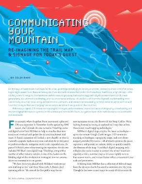
RE-IMAGINING THE TRAIL MAP

        & SIGNAGE FOR TODAY’S GUEST


        _ BY COLIN BANE


        Are the days of hand-drawn trail maps for ski areas, painted painstakingly to convey an artistic, serene mountain view of ski areas,
        beginning to wane? Sure, there will always be those die-hard ski areas that prefer the throw-back, traditional, arty trail map—after
        all, they contend, we go to the mountains and ski areas to get away from technology and truly disconnect from it all. But new
        generations, accustomed to technology and its convenience and ease-of-use (let’s call them the Digerati) are demanding more
        user-friendly mountain maps and guest information platforms, and vendors are responding to these demands with inventive and
        novel technologies that are changing how we communicate with our guests on the mountain.
            With today’s digital, 3-D interactive mapping technologies and animations, drones and aerial photography, virtual reality, and
        real-time digital information systems on HD screens and even on lift chairs, our guests have never had information so accessible
        and immediate.


              or example, when Arapahoe Basin announced a planned   new expansion terrain, the Beavers & the Steep Gullies. We’re
              338-acre expansion in November for the upcoming 2018   looking forward to having an updated trail map that utilizes
        F season, the Colorado ski area turned to VistaMap owner   these newer visual mapping technologies.”
        and digital artist Gary Milliken to help re-visualize their new   Milliken’s digital maps employ the latest technologies—
        terrain and overhaul and update the ski area’s traditional trail   up-to-the-minute Google Earth images, 3-D mountain
        maps. A-Basin’s expansion will include a new chairlift in what is   mapping technologies, topography maps, and even drone
        currently a popular backcountry zone and allow for its ski patrol   imagery provided by resorts—all of which optimize the guest
        to perform avalanche mitigation work in the expanded area. As   experience and provide an infinite ability to quickly modify
        part of A-Basin’s press release touting the expansion, the ski area   the elements of the map. VistaMap’s digital mapping tech-
        included Milliken’s new digital map. VistaMap, along with a   nologies also make it easier to convert the winter mountain
        number of other industry vendors, is one of the leaders on the   experience into a summer map as ski areas rapidly turn to
        bleeding edge of this revolution to re-imagine how we commu-  four-season resorts, and in turn better reflect a mountain’s true
        nicate our mountains to our guests.                     scale and proportion.
            “We have been very pleased with Milliken’s work on our   A lifelong skier, Milliken has a collection of old trail maps
        new trail map so far,” said Alan Henceroth, A-Basin’s chief   from the ski areas that he has saved as souvenirs over the years.
        operating officer. “He created the first public map for our   Though he has now created maps for nearly 40 ski areas in the


        30  |  NSAA JOURNAL  |  CONVENTION 2017