
Page 29 - EM SOCIAL NOTES 10TH CLASS PSR DIGITAL BOOKS
P. 29
3. The Indian plateau is slightly tilted towards east.
4. The Deccan plateau is a triangular landmass. MOUNTAIN
5. Satpura range forms the Deccan plateau’s north edge.
6. The plateau consists of two divisions namely, Malwa and
Deccan.
7. Western Ghats, Eastern Ghats and Nilgiris form western,
eastern and southern boundaries to the Deccan plateau.
8. The eastern edge of Deccan plateau is Mahadev range.
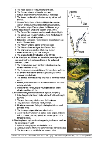
3. Write about Eastern Ghats and western Ghats. (AS1)
1. The Eastern Ghats extends from Mahanadi valley to Nilgiris.
2. The highest peak in Eastern Ghats is Aroya Konda found at
Chinthapalli near Visakhapatnam.
3. Nallamalas, Velikondas, Palakondas and Seshachala are the
AROYA
tracts of Eastern Ghats. KONDA
4. The Western Ghats lie parallel to the west coast.
5. The Western Ghats are higher than Eastern Ghats.
Nallamalas, Velikondas, Palakondas and Seshachala are the
6. The Nilgiris joins the Western Ghats near Gudalur.
7. Dodda Betta is the highest peak in Nilgiris. NILGIRIS
8. The average height of the Eastern Ghats 900 mts.
4. If the Himalayas would have not been in its present position
how would be the climatic conditions of the Indian sub
continent? (AS1)
1. The Himalayas play a very significant role influencing the TERRACED SLOPES
climatic conditions of India.
2. The Himalayas cause precipitation in the form of rain and snow.
3. In absence of Himalayas there is no possibility for tropical
monsoon type of climate.
4. The absence of Himalayas may tend India to become a tropical
desert.
5. Besides, they prevent the cold air masses of central Asia from
entering into India.
6. In this way the Himalayas play very significant role on the
climatic conditions of India.
5. How the Himalayas influences Indian agriculture? (AS1) RIVER DELTA
1. Indo - Gangetic plain is very fertile with the fine Alluvial brought
by rivers.
2. The great rivers carry alluvium from the Himalayas.
3. They are suitable for growing variety of crops.
4. Himalayas serve water for irrigation being the birth places of
perennial rivers.
5. The Himalayan slopes offer terraced cultivation.
6. A wide variety of fruits such as apples, pears, grapes, mulberry,
walnut, cherries, peaches, apricot, etc. are also grown in the
Himalayan region.
6. Why the plateau regions do not support agriculture as much as
the plain regions? (AS1)
1. A plain is a low lying land with leveled surface.
2. A plateau is an area of fairly level high ground to the surrounding area.
COSTAL PLAINS
3. The plains are most suitable for human occupation.
TEACHER AND STUDENT PUBLICATIONS, ONLY 10TH CLASS (23) PSR DIGITAL BOOKS (ONLINE&OFFLINE), ALL SUBJECTS (TM&EM) 9885678410