
Page 9 - TCL International VILLETA BUSINESS PLAN AND FEASABILITY STUDY
P. 9
The economy had experienced a downturn in 2015 because of lower price
of grains. A similar situation happened in 2009 because of rain shortfall.
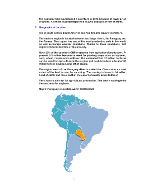
B. Geographical Location
It is in south-central South America and has 406,000 square kilometers.
The eastern region is located between two large rivers, the Paraguay and
the Parana. This region has one of the most productive soils in the world
as well as benign weather conditions. Thanks to those conditions, that
region produces multiple crops annually.
Over 20% of the country’s GDP originates from agricultural production. At
present 3.3 million hectares is used for planting crops such as soybean,
corn, wheat, canola and sunflower. It is estimated that 12 million hectares
can be used for agriculture in this region and could produce a total of 30
million tons of soybean, plus other grains.
The region west of the Paraguay River is called the Chaco where a vast
extent of the land is used for ranching. The country is home to 14 million
head of cattle and ranks sixth in the export of quality grass fed beef.
The Chaco is also apt for agricultural production. This land is waiting to be
the next area for soybean.
Map 2: Paraguay’s Location within MERCOSUR
4