
Page 13 - oct mag5a_Neat
P. 13
The most popular hiking route in the Calico Hills is the Calico Tanks trail. Starting at the Sandstone Quarry park-
ing area near Mile Marker 3 on the scenic drive, this trail crosses a wash, a conduit for owing water after a heavy
rain, and passes an agave roasting pit. This pit was used for roasting game and vegetables by natives about 800
years ago. The natives used limestone much as we use charcoal today, as it had the ability to retain heat for a
period of time. When the limestone cooled and was no longer able to hold heat, the remains were raked to the
sides, forming the pit. The edges of these pits often include a mixture of bones and other remnants, making for
an intriguing look back into the past.
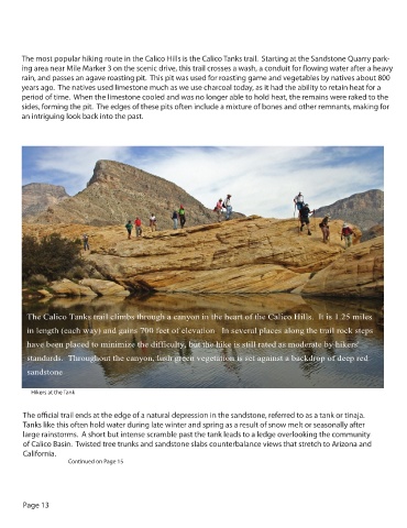
The Calico Tanks trail climbs through a canyon in the heart of the Calico Hills. It is 1.25 miles
in length (each way) and gains 700 feet of elevation. In several places along the trail rock steps
have been placed to minimize the difficulty, but the hike is still rated as moderate by hikers'
standards. Throughout the canyon, lush green vegetation is set against a backdrop of deep red
sandstone
Hikers at the Tank
The o cial trail ends at the edge of a natural depression in the sandstone, referred to as a tank or tinaja.
Tanks like this often hold water during late winter and spring as a result of snow melt or seasonally after
large rainstorms. A short but intense scramble past the tank leads to a ledge overlooking the community
of Calico Basin. Twisted tree trunks and sandstone slabs counterbalance views that stretch to Arizona and
California.
Continued on Page 15
Page 13