
Page 72 - World Airnews Magazine December 2020
P. 72
DRONES
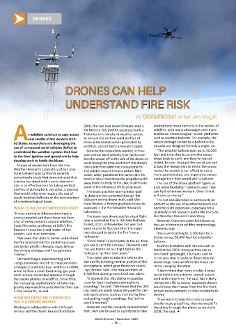
DRONES CAN HELP
UNDERSTAND FIRE RISK
By Dronelife staff writer Jim Magill
(DRI), the San Jose research team used a atmospheric measurements in the vicinity of
DJI Matrice 200 (M200) equipped with a wildfires, with many advantages over more
s wildfires continue to rage across TriSonica mini wind and weather sensor, traditional meteorological- sensor platforms
Avast swaths of the western Unit- to sample the vertical wind profiles of such as weather balloons. For example, the
ed States, researchers are developing the three-dimensional winds generated by sensor package carried by a balloon is dis-
use of unmanned aerial vehicles (UAVs) to wildfires, according to a research paper. posable and designed for only a single use.
understand the weather systems that lead Because the researchers wanted to mea- “The weather balloon goes up to 50,000
to the fires’ ignition and spread and to help sure vertical wind velocity, that had to posi- feet and then they burst and the sensor
drops back to earth and they’re not col-
develop tools to battle the blazes. tion the sensor off to the side of the drone, to lected, he said. Because the use of a drone
avoid having the prop wash from the drone’s
A team of researchers from the Fire rotors interfere with their measurements. allows the researchers to retain the sensor
Weather Research Laboratory at San Jose The solution was to install a carbon-fibre reuse, the scientists can afford to use a
State University in California recently boom, which positioned the sensor at a dis- more sophisticated, and expensive, sensor
completed a study that demonstrated that tance of about two times the propeller width package than they would with a balloon.
a drone equipped with a sonic anemom- away from the body of the UAV, to eliminate The use of the drone platform “gives us
eter is an effective tool for taking vertical some of the influences of the prop wash. a lot more flexibility,” Clements said. “We
profiles of atmospheric variables, a process can fly it wherever we want. Over time it
that would otherwise require the use of The team used the anemometer with will save us money.”
costly weather balloons or the construction its data monitor powered through the
USB port on the drone itself, said Mat-
of a meteorological tower. The last consideration is particularly im-
thew Brewer, a former graduate research portant as the use of weather balloons can
WHAT IS WILDFIRE METEOROLOGY? assistant in the Fire Weather Research become quite expensive, especially for a
“It tuns out the wildfire environment is Laboratory. relatively small research entity like the SJSU
poorly sampled and there have not been The team took drone out for a test flight Fire Weather Research Laboratory.
a lot of measurements around wildfires,” near a controlled fire in Fish lake National However, there are some limitations to
Craig Clements, professor at SJSU’s Fire Forest, Utah, in November last year but the use of drones in wildfire meteorology,
Research Laboratory and leader of the were unable to fly close after the organ- Clements said.
project, said in an interview. isers decided to ignite the fire from a One is vertical height, 1,500 feet for a
“We need that data to better understand helicopter. drone, versus 50,000 feet for a weather
the fire environment for modelling so we “Once there’s a helicopter in the air, then balloon.
can better predict changes, especially as you really can’t fly a drone,” Clements said. Another limitation with drones such as
the climate changes and fires get more “So, we had to do our flight before the the Matrice 200 is because they are so
intense.” helicopter ignition took place.” small and lightweight, Clements said he
Clements began experimenting with They were able to take the UAV to the is not sure that it could be flown directly
using unmanned aircraft to measure mete- site and fly it, taking vertical profiles of the above large-scale wildfires like those cur-
orological conditions near wildfires in 2008, atmosphere, which gave them two sound- rently ravaging the West.
when he flew a small fixed-wing, gas-pow- ings, Brewer said. One measurement at “I don’t think that many smaller drones
ered remote-controlled airplane through 1,500 feet above ground level was taken. could handle the extreme updraft associ-
the smoke plumes of wildfires. Since then, “It showed that this platform could be ated with these fires,” he said. More likely
the increasing sophistication of UAVs has used for high-resolution atmospheric researchers flying sensor-equipped drones
greatly expanded the potential for their use sounding,” he said. “We found that the UAS would keep them away from the fire front,
in fire research, he said. can measure winds reasonably well for cer- to take measurements in close proximity to
tain applications, such as monitoring fires the fire.
HOW WILDFIRE METEOROLOGY and getting rough soundings. But further “If we were to take the drone to some
WITH A DRONE WORKS work is needed.” smaller-scale grass fires, then we would fly
Working in collaboration with US forest Clements said the research demonstrated the drone through the plume as we did in
service and the Desert Research Institute that UAVs can be used as a platform to take 2008,” he said. Q
World Airnews | December 2020
— 46 —