
Page 11 - spring 2016 flip
P. 11
Friends oF red rock canyon 11
power was used to generate
electricity or to power tools
used at the quarry site. The
application was submit-
ted on December 24, 1906
and proof-of-use filed on
August 7, 1907.
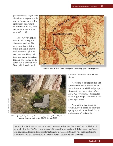
The 1907 topographic
map of the Las Vegas area
shows the pipeline. The
map submitted with the
water application shows
the location of a pipeline
and quarry buildings. The
topo map seems to indicate
the dam was located on the
south side of the Red Rock
Wash which would put it
Detail of 1907 United States Geological Survey Map of the Las Vegas area
closer to Lost Creek than Willow
Springs.
According to the application and
approved certificate, the amount of
water flowing from Willow Springs,
if accurate, was staggering – three
cubic feet per second! This equates
to 22.44 gallons per second or 1,346
gallons per minute.
Photo by Chuck Williams counts, Lincoln Stone did not begin
According to newspaper ac-
quarry operations until early 1909
Willow Spring today showing the remaining portion of the wildlife/cattle and was out of business in 1911.
guzzler that was built by the CCC in the late 1930s
Information for this story was found after “Seekers, Saints and Scoundrels” was published. A
closer look at the 1907 topo map suggested the pipeline existed which led to a search of water
applications. Additional historic information about Red Rock Canyon will likely continue to
accumulate and will be included in the book when a second edition is printed.
Spring 2016