
Page 8 - spring 2016 flip
P. 8
8 Friends oF red rock canyon
Photos and authored by
Norm Kresge
ravel the Hooch Highway to trail is not marked along the way except in
get there, but you’ll have to a few places where mountain bikers have
bring your own. As far as I can placed trail signs. From the low point, the
T tell, no one is brewing their trail crosses some other bike trails but it’s
hooch here anymore. This hike is in Bootleg marked.
Canyon at Boulder City and was created by
the mountain bikers you periodically see on On the way down, as you round the one
the trail. The total distance is 4.3 miles and I ridge, you see most of the Las Vegas Val-
rate the hike easy/moderate. ley. There are good views across the valley
of Mount Charleston and other parts of the
From the Spring Mountains. Enjoy the vista and take
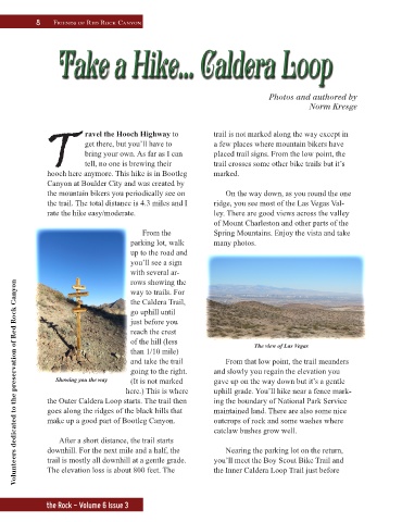
parking lot, walk many photos.
up to the road and
you’ll see a sign
with several ar-
rows showing the
Volunteers dedicated to the preservation of Red Rock Canyon
way to trails. For
the Caldera Trail,
go uphill until
just before you
reach the crest
of the hill (less The view of Las Vegas
than 1/10 mile)
and take the trail From that low point, the trail meanders
going to the right. and slowly you regain the elevation you
Showing you the way (It is not marked gave up on the way down but it’s a gentle
here.) This is where uphill grade. You’ll hike near a fence mark-
the Outer Caldera Loop starts. The trail then ing the boundary of National Park Service
goes along the ridges of the black hills that maintained land. There are also some nice
make up a good part of Bootleg Canyon. outcrops of rock and some washes where
catclaw bushes grow well.
After a short distance, the trail starts
downhill. For the next mile and a half, the Nearing the parking lot on the return,
trail is mostly all downhill at a gentle grade. you’ll meet the Boy Scout Bike Trail and
The elevation loss is about 800 feet. The the Inner Caldera Loop Trail just before
the Rock - Volume 6 Issue 3