
Page 29 - KAFSP Vision Camp - Guide
P. 29
KAFSP Vision Camp 2024 [25]
l 도라전망대(도라OP)는 대한민국 경기도 파주시 진동면에 위치한 군사전망대입니다. 이 전망대는 남북한 간의 분단 현실을
직접 체험할 수 있는 장소로, 민간인이 접근할 수 있는 가장 북쪽에 위치한 곳 중 하나입니다. 도라전망대는 방문객들에게
남북한의 현실을 눈으로 확인할 수 있는 기회를 제공합니다.
l 도라전망대는 단순한 관광지가 아닌, 남북 분단의 현실을 체감하고 평화와 통일의 중요성을 되새기는 장소입니다. 이곳에서
방문객들은 분단의 아픔을 느끼고, 평화와 통일을 염원하는 마음을 키울 수 있습니다.
l 북한 지역 관찰: 도라전망대에서는 망원경을 통해 북한 지역을 직접 관찰할 수 있습니다. 개성공단, 송악산, 개성 시내 등의
북한 주요 시설들을 멀리서나마 볼 수 있습니다.
l 개성공단: 개성공단은 남북 경제 협력의 상징이었던 곳으로, 도라전망대에서 그 모습이 보입니다.
l 북한 기정동 마을: 선전 마을로 알려진 기정동 마을도 도라전망대에서 관찰할 수 있습니다. 이 마을은 북한의 선전
목적으로 지어진 마을입니다.
l 군사분계선: 군사분계선과 그 너머의 북한 지역을 한눈에 볼 수 있어, 분단의 현실을 체감할 수 있습니다.
l 도라전망대 방문은 한국의 역사적 상황을 이해하고, 평화와 통일의 가치를 되새기는 의미 있는 경험이 될 것입니다.
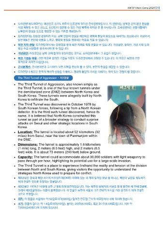
The Third Tunnel of Aggression - 제3땅굴
l The Third Tunnel of Aggression, also known simply as
the Third Tunnel, is one of the four known tunnels under
the demilitarized zone (DMZ) between North Korea and
South Korea. These tunnels were allegedly built by North
Korea to infiltrate the South.
l The Third Tunnel was discovered in October 1978 by
South Korean forces, following a tip from a North Korean
defector. It is the third such tunnel discovered, hence its
name. It is believed that North Korea constructed this
tunnel as part of a broader strategy to conduct surprise
attacks on Seoul and other strategic locations in South
Korea.
l Location: The tunnel is located about 52 kilometers (32
miles) from Seoul, near the town of Panmunjom within
the DMZ.
l Dimensions: The tunnel is approximately 1.6 kilometers
(1 mile) long, 2 meters (6.5 feet) high, and 2 meters (6.5
feet) wide. It is about 73 meters (240 feet) below ground.
l Capacity: The tunnel could accommodate about 30,000 soldiers with light weaponry to
pass through per hour, highlighting its potential use for a large-scale invasion.
l The Third Tunnel is a place to experience firsthand the reality and tension of the division
between North and South Korea, giving visitors the opportunity to understand the
strategies North Korea used to prepare for conflict.
l 제3땅굴은 한국과 북한 사이의 비무장지대(DMZ) 아래에 있는 네 개의 알려진 땅굴 중 하나로, 북한이 남한을 침투하기
위해 건설한 것으로 추정되는 땅굴입니다.
l 제3땅굴은 1978년 10월에 남한 군대에 의해 발견되었습니다. 이는 북한의 탈북자의 제보를 통해 발견된 세 번째 땅굴로,
그래서 제3땅굴이라는 이름이 붙여졌습니다. 이 땅굴은 북한이 서울과 다른 전략적 위치를 기습 공격하기 위해 건설한
것으로 추정됩니다.
l 위치: 이 땅굴은 서울에서 약 52킬로미터(32마일) 떨어진 판문점 근처의 비무장지대 내에 위치해 있습니다.
l 크기: 땅굴의 길이는 약 1.6킬로미터(1마일), 높이는 2미터(6.5피트), 폭은 2미터(6.5피트)입니다. 지하 약
73미터(240피트)에 위치해 있습니다.