
Page 19 - RemoteSnsing&GIS by PK Gogoi
P. 19
14
13
be operated. For remote sensing applications, The height of ground based platform is irborne platforms are used to atellites are man made objects that revolve
sensors should be mounted on suitable stable from a few meters to 50 Km or in the other Acollect very detailed images and Saround the earth and sensors installed
platforms. These platforms can be ground based, words we can say that the ground based features. The collection of data over any portion onboard captures data of the earth's surface
air borne or space borne based. platforms are found bellow 50 Km from the of Earth's surface at any time but it is very covering areas of more than hundreds of square
As the platform height increases the Earth surface. expensive platform as compared to ground based kilometers. Because of their orbits, satellites
observational area increases. Thus, higher the platforms .There are some examples of airborne permit repetitive coverage of the earth's surface
sensor is mounted; larger synoptic view is platform on a continuing basis. There are two types of
obtained. The types or characteristics of .Drones /UAV : Drone is a miniature well recognized satellite platforms: which are
platform depend on the type of sensor being 1remotely piloted aircraft. It is designed to ‘Manned Satellite Platforms’ like Space
attached and its necessity of researcher. fulfill requirements for a low cost platform, with Shuttles, Space crafts, International Space
Depending on task, platform can vary from long endurance, moderate payload capacity and Stations etc. and ‘Unmanned Satellite Platforms’
ladder to satellite. Following are the three types capability to operate without a runway or small like Landsat series, SPOT series and IRS series
of platform runway. Drone includes equipment of of remote sensing satellite NOAA series of
.4.1.1 Ground based platform photography, infrared detection, radar meteorological satellites, the entire constellation
Ground platforms are used to record observation and TV surveillance. It uses of the GPS satellites and the GOES and INSAT
2detail information about the surface very satellite communication link. An onboard series of geostationary environmental are
closely. Some example of ground based computer controls the payload and stores data examples of unmanned satellite category.
platform are from different sensors and instruments. .4.1.3.a Space Borne Platforms (On the
I ground vehicle (Mobile Hydraulic Platform) : 2basis of orbital height )
. Rockets as Platforms : Prior to use of
Sensor is fixed at a height of 15 meter above the
2airplanes, aerial photographs were obtained n highlighting the satellite sensors placed at
ground with a hydraulic platform.
by rocketing a camera nto the sky and then Idifferent heights ,especially in space ,and
2 tower : At the cell phone tower, sensor is fixed
retrieving the camera and film. The high altitude used for satellite remote sensing for acquiring
and aerial data are received.
sounding rocket is fired from a mobile launcher. optical image , it is to be mentioned that on the
3 air balloon : Altitude range is 22 to 40 Km. It
During the flight it takes snapshot from above
is used for collection of data related to
the earth and decend down in a capsule.
monitor weather phenomenon,
. Aeroplane : High spatial resolution 20 cm
pollution etc Balloons Balloons are
3or less can be obtained by sensors from the
used for remote sensing observation
aircraft. Analog photography is possible. It is
(aerial photography) and nature
cost effective and nedds continues fly.
conservation studies. Balloon floats
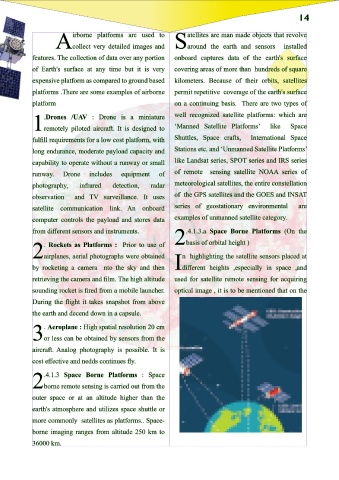
.4.1.3 Space Borne Platforms : Space
at a constant height of about 30 km.
2borne remote sensing is carried out from the
t consists of a rigid circular base plate
for supporting the entire sensor system which 2.4.1.2 Air borne plattform : outer space or at an altitude higher than the
earth's atmosphere and utilizes space shuttle or
is protected by an insulating and shock proof
more commonly satellites as platforms.. Space-
light casing.
borne imaging ranges from altitude 250 km to
36000 km.