
Page 890 - engelsk
P. 890
Navigation
9.10.1 How GNSS systems work
GNSS systems consist of a constellation of satellites orbiting the Earth.
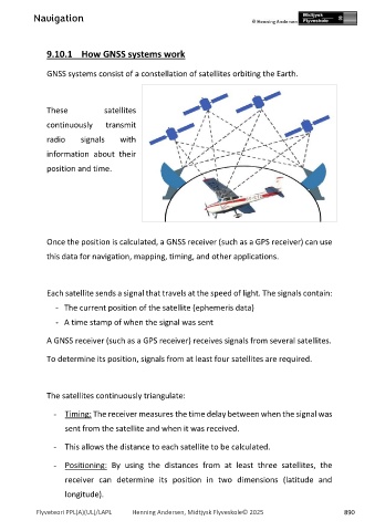
These satellites
continuously transmit
radio signals with
information about their
position and time.
Once the position is calculated, a GNSS receiver (such as a GPS receiver) can use
this data for navigation, mapping, timing, and other applications.
Each satellite sends a signal that travels at the speed of light. The signals contain:
- The current position of the satellite (ephemeris data)
- A time stamp of when the signal was sent
A GNSS receiver (such as a GPS receiver) receives signals from several satellites.
To determine its position, signals from at least four satellites are required.
The satellites continuously triangulate:
- Timing: The receiver measures the time delay between when the signal was
sent from the satellite and when it was received.
- This allows the distance to each satellite to be calculated.
- Positioning: By using the distances from at least three satellites, the
receiver can determine its position in two dimensions (latitude and
longitude).
Flyveteori PPL(A)(UL)/LAPL Henning Andersen, Midtjysk Flyveskole© 2025 890