
Page 895 - engelsk
P. 895
Navigation
9.10.3 GPS
In Denmark, aircraft primarily use GPS as a GNSS system.
GPS stands for Global Positioning System.
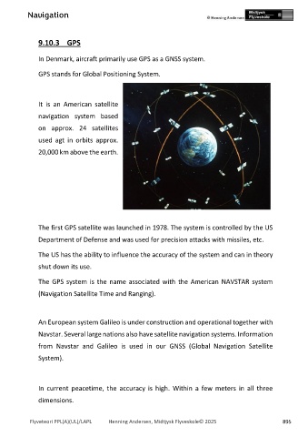
It is an American satellite
navigation system based
on approx. 24 satellites
used agt in orbits approx.
20,000 km above the earth.
The first GPS satellite was launched in 1978. The system is controlled by the US
Department of Defense and was used for precision attacks with missiles, etc.
The US has the ability to influence the accuracy of the system and can in theory
shut down its use.
The GPS system is the name associated with the American NAVSTAR system
(Navigation Satellite Time and Ranging).
An European system Galileo is under construction and operational together with
Navstar. Several large nations also have satellite navigation systems. Information
from Navstar and Galileo is used in our GNSS (Global Navigation Satellite
System).
In current peacetime, the accuracy is high. Within a few meters in all three
dimensions.
Flyveteori PPL(A)(UL)/LAPL Henning Andersen, Midtjysk Flyveskole© 2025 895