
Page 84 - Art In The Age Of Exploration (Great Section on Chinese Art Ming Dynasty)
P. 84
MAPS AND THE RATIONALIZATION
OF GEOGRAPHIC SPACE
David Woodward
M .odern historians have emphasized that illustrate the three great races of the world — Mediterranean sea charts —the so-called porto-
both the abruptness and significance of the the Semitic, hamitic, and Japhetic. These T-in-O lan charts —are technological marvels whose
change from the medieval to the modern world maps, of which early typical examples appeared origin has still not been fully explained. They
1
have been grossly exaggerated. Rather than in the Encyclopedia of Saint Isidore of Seville seem to have been based on books of sailing
focusing on the fifteenth century as a time of (seventh century), were, with important excep- directions (statements of sailing distances with a
dramatic transition between the two ages, as tions, usually circular, oriented to the east, and traditional wind direction). The earliest surviv-
earlier historians had done, they point backward centered on the Holy Land. Well-known large ing example is the Carte Pisane (c. 1275). Their
to the several renaissances that took place in the examples based on this model included the structure could therefore be said to be route-
Middle Ages and forward to the medieval and Ebstorf map (1239) and the Hereford map enhancing. Their frames result from the natural
occult character of much sixteenth- and seven- (c. 1290). The frame and center of these maps shape of the sheepskin that was the source of
teenth-century science. Although this caution are rigidly predetermined, and the scale natu- the vellum, and their centers are arbitrary,
is also appropriate when discussing the specific rally changes in proportion to the relative famil- based on the geometry of the radiating direc-
case of the conceptual shift between medieval iarity of the area being represented. These maps tional lines. Although at first confined to the
and Renaissance cartography, the overwhelming reflect a blending of history and geography, a Mediterranean and Black seas, the scope of such
conclusion is still that a rapid and radical change projection of history onto a geographical frame- maps was soon expanded to encompass the
in the European world view took place during work, emphasizing the spiritual rather than the known world, as in the Catalan Atlas of c. 1375
the fifteenth century. physical world. On them could be represented (cat. i).
In retrospect we can see that in the late the symbols of the deepest Christian truths: the At the beginning of the fifteenth century, a
Middle Ages there were several fundamentally earth as a record of divinely planned historical new concept of ordering geographic space was
different ways of looking at geographic space events from the Creation of the world through introduced to the Christian West. Although
and representing geographic reality. One relied its salvation by Jesus Christ in the Passion to Roger Bacon in his Opus mains (c. 1265), had
on the concept of consistent physical measure- the Last Judgment. Mappaemundi were them- already proposed mapping the earth with coor-
ment and scale, another on the notion of vary- selves epitomes of the earth and the cosmos, dinates of latitude and longitude, it was a cen-
ing scale depending on perceived importance or showing the physical relationships among earth,
the affective qualities of iconography, and man, and God.
another stressed qualitative topological relation- Similar in function, but quite different in
ships of adjacency and connectedness rather structure, were the zonal maps, in which the
than those of measured distance and area. It is medieval church adopted the Hellenistic Greek
not unusual to find side by side, and often in model of the earth divided into five climatic
the same manuscript, maps drawn on different zones. This concept, which can be traced back to
structural frameworks and with widely different the ancient Greek philosophers Aristotle and
functions. In many fifteenth-century world Parmenides, postulated two temperate and
maps, the various structures appear even within habitable zones (the oikoumene and the anti-
the confines of the same map: a frame and podes), a torrid uninhabitable zone at the equa-
center of an iconographical medieval mappa- tor and two frigid uninhabitable zones at the
mundi (world map), the configuration of a mea- poles. It was transmitted to the medieval world
sured nautical chart for the Mediterranean, and largely through manuscripts of Macrobius'
towns, rivers, and regions topologically fitted in Commentary on the Dream of Scipio (fifth cen-
between. tury) and dramatically illustrated the Christian
The medieval mappaemundi were derived dilemma of incorporating into Christ's flock a
from two fundamentally different sources. On potential fourth race of people to the south in
the one hand, there were the maps of the known the antipodean temperate zone that could not be
world (sometimes known as T-in-O maps, from reached through the impassable equator. The
their layout), derived from Roman sources in zonal maps were circular, like the T-in-O maps,
which the world was divided into the three but were usually oriented to the north. Combi-
known continents: Asia, Africa, and Europe. nations of the two types appeared in many
This concept was readily adapted by the Chris- forms.
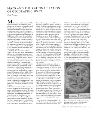
tian church to accommodate the biblical notion In the thirteenth century, a completely dif- fig. i. Simon Marmion, World Map (T-in-O Map).
of the world as divided among the three sons of ferent kind of map appeared, based on maritime From Jean Mansel, Fleur des Histoires, MS 9231.
Noah — Shem, Ham, and Japheth — and thus to measurements of distance and direction. The Bibliotheque Royale Albert i , Brussels
er
EUROPE AND THE MEDITERRANEAN WORLD 83