
Page 254 - Proceeding of Atrans Young Researcher's Forum 2019_Neat
P. 254
“Transportation for A Better Life:
Smart Mobility for Now and Then”
23 August 2019, Bangkok, Thailand
2. Literature Reviews has high flood risks. The reason for this is that the
Many studies have analyzed the impact on Mun river is flowing the center of the city.
traffic networks and discussed the measures for To minimize the flood damage, many of the
urban disasters such as heavy rainfall or earthquakes. houses at the riverside of the city are raised-floor-
For example, Yamashita et al. investigated the style houses, as shown in Fig 3.
change of accessibility under the different condition
of inundation depth by using accessibility indicator
in Bangkok, Thailand. Pregnolato et al. analyzed the
relationship between the level of inundation and
vehicle speed under the massive amounts of rain
occurrence. Also, Misakis et al. examined the impact
of large fires on traffic networks. In their study,
blockage of road sections is dynamically represented
using time series fire data. Besides, Chen et al.
analyzed the impact of road blockage by using
accessibility indicators and revealed that road
network function is reduced by up to about 40% in
the disaster. Erik et al. analyzed the impact of
disasters on the road network by using the Dijkstra
method. Fig. 1 Location of study area
On the other hand, many existing studies
also discussed the priority of implementing
countermeasures in the disaster. For example,
Kitamura et al. prioritized the need for road
improvement in dense snow areas in the hills and
mountains. Ando et al. developed the evaluation
indexes based on the mountainous regions of Gifu
prefecture of Japan. And then, the prioritization of
road maintenance is based on the opinions of
residents.
In these existing studies, the prioritization
taking into consideration the impact on the traffic
network at the time of disaster occurrence is
performed. However, the quantitative analysis of the
effect of subsequent measure introduction is Fig. 2 Flood risk in Ubon Ratchathani, Thailand
insufficient.
Hence, this study clarified the effects of the
measures from the simulation results by using the
inundation situation of the road network and the road
congestion section.
3. Methodology
3.1 Study Area
As a case study, we selected Ubon
Ratchathani which located in the northeastern part of
Thailand (Fig. 1). It has covered an area of 105
square kilometers and, a population of about 0.25
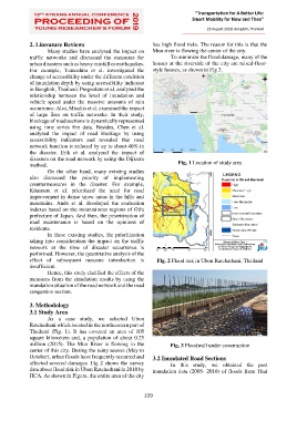
million (2015). The Mun River is flowing in the Fig. 3 Floodwall under construction
center of this city. During the rainy season (May to
October), urban floods have frequently occurred and 3.2 Inundated Road Sections
affected severed damages. Fig 2 shows the survey In this study, we obtained the past
data about flood risk in Ubon Ratchathani in 2010 by inundation data (2005- 2016) of floods from Thai
JICA. As shown in Figure, the entire area of the city
229