
Page 891 - PPL-engelsk 2025
P. 891
Navigation
GNSS enables precise and reliable positioning and navigation data using satellite
signals.
GPS is the best-known GNSS, but there are also other systems, e.g.:
- GLONASS (Russia)
- Galileo (EU)
- BeiDou (China)
9.10.1 How GNSS systems work
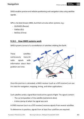
GNSS systems consist of a constellation of satellites orbiting the Earth.
These satellites
continuously transmit
radio signals with
information about their
position and time.
Once the position is calculated, a GNSS receiver (such as a GPS receiver) can use
this data for navigation, mapping, timing, and other applications.
Each satellite sends a signal that travels at the speed of light. The signals contain:
- The current position of the satellite (ephemeris data)
- A time stamp of when the signal was sent
A GNSS receiver (such as a GPS receiver) receives signals from several satellites.
To determine its position, signals from at least four satellites are required.
Flyveteori PPL(A)(UL)/LAPL Henning Andersen, Midtjysk Flyveskole© 2025 891