
Page 890 - PPL-engelsk 2025
P. 890
Navigation
A DME station can only service a limited number of users at a time.
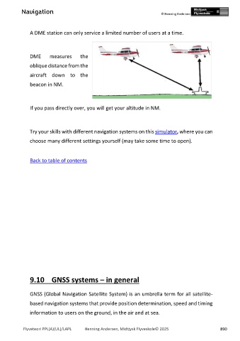
DME measures the
oblique distance from the
aircraft down to the
beacon in NM.
If you pass directly over, you will get your altitude in NM.
Try your skills with different navigation systems on this simulator, where you can
choose many different settings yourself (may take some time to open).
Back to table of contents
9.10 GNSS systems – in general
GNSS (Global Navigation Satellite System) is an umbrella term for all satellite-
based navigation systems that provide position determination, speed and timing
information to users on the ground, in the air and at sea.
Flyveteori PPL(A)(UL)/LAPL Henning Andersen, Midtjysk Flyveskole© 2025 890